Image:SCO Map.png
From Wikipedia, the free encyclopedia
No higher resolution available.
SCO_Map.png (554 × 338 pixels, file size: 18 KB, MIME type: image/png)
| | This is a file from the Wikimedia Commons. The description on its description page there is shown below.
|
remove Taiwan from this map or the map will be removed from the SCO article. Willy turner 02:36, 14 June 2007 (UTC)
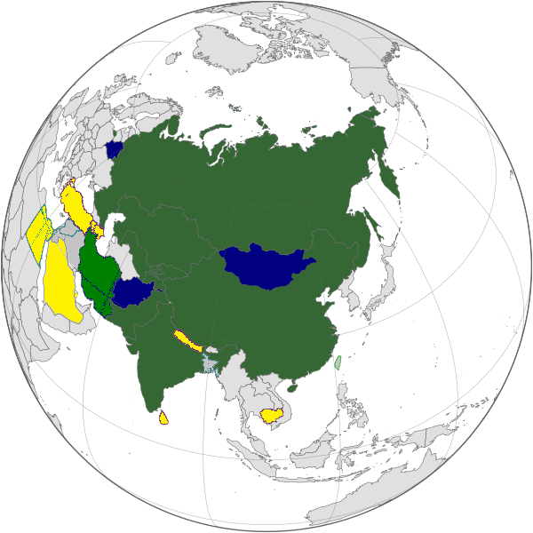
Map of the Shanghai Cooperation Organization. Blue: Member states. Green: Observer status.
Created by User:Aris Katsaris.

File history
Click on a date/time to view the file as it appeared at that time.
| Date/Time | Dimensions | User | Comment | |
|---|---|---|---|---|
| current | 21:08, 12 July 2007 | 554×338 (18 KB) | Briangotts | (Map of the Shanghai Cooperation Organization. Blue: Member states. Green: Observer status. Created by User:Aris Katsaris. {{GFDL}} Category:Subcontinental maps ) |
| 11:15, 19 May 2007 | 554×338 (18 KB) | Hoshie | (added Montenegro. under same lic. as original.) | |
| 10:01, 25 June 2006 | 554×338 (14 KB) | AlefZet | (Reverted to earlier revision) | |
| 10:08, 24 May 2006 | 554×338 (13 KB) | Aris Katsaris | (Reverted to earlier revision) | |
| 11:54, 22 April 2006 | 554×338 (14 KB) | Wassily | ||
| 21:05, 15 March 2006 | 554×338 (13 KB) | Aris Katsaris | (oops, forgot to crop to the area in question.) | |
| 21:03, 15 March 2006 | 1,357×628 (52 KB) | Aris Katsaris | (better coloration (I think), to fit in with that of other post-Soviet orgs.) | |
| 07:41, 10 June 2005 | 536×300 (13 KB) | Yongxinge | (update) | |
| 07:37, 10 June 2005 | 536×300 (13 KB) | Yongxinge | (Update map according to the meeting in this month.) | |
| 19:52, 12 April 2005 | 536×300 (9 KB) | Aris Katsaris | (Map of the Shanghai Cooperation Organization. Blue: Member states. Green: Observer status. Created by User:Aris Katsaris. {{GFDL}}) |
File links
The following pages on the English Wikipedia link to this file (pages on other projects are not listed):

