Image:Schoonrewoerd 1868.png
From Wikipedia, the free encyclopedia
Size of this preview: 691 × 599 pixels
Full resolution (1,628 × 1,412 pixels, file size: 159 KB, MIME type: image/png)
| | This is a file from the Wikimedia Commons. The description on its description page there is shown below.
|
| Description |
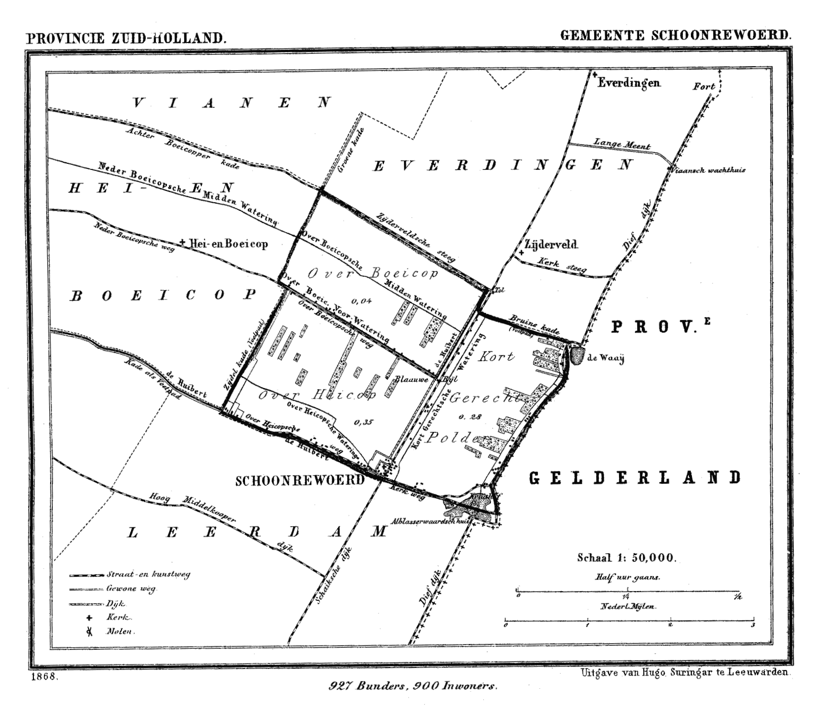
Historic map of Schoonrewoerd (now part of municipality Leerdam), South Holland, the Netherlands |
|---|---|
| Source |
Gemeente Atlas van Nederland (Municipal Atlas of the Netherlands) |
| Date |
1865-1870 |
| Author |
J. Kuyper |
| Permission (Reusing this image) |
see below |
[edit] Licensing
| This image (or other media file) is in the public domain because its copyright has expired. This applies to the United States, Canada, the European Union and those countries with a copyright term of life of the author plus 70 years.
العربية | Asturianu | Български | Català | Česky | Dansk | Deutsch | English | Ελληνικά | Esperanto | Español | Euskara | فارسی | Français | Gaeilge | Galego | עברית | हिन्दी | Bahasa Indonesia | Italiano | 日本語 | 한국어 | Kurdî / كوردی | Lietuvių | Magyar | Nederlands | Norsk (nynorsk) | Bahasa Melayu | Polski | Português | Română | Русский | Slovenčina | Slovenščina | Shqip | Suomi | Sámegiella | Türkçe | 中文(简体) | 中文(繁體) | 粵語 | +/- |
File history
Click on a date/time to view the file as it appeared at that time.
| Date/Time | Dimensions | User | Comment | |
|---|---|---|---|---|
| current | 19:00, 1 October 2007 | 1,628×1,412 (159 KB) | P199 | ({{Information |Description=Historic map of Schoonrewoerd (now part of municipality Leerdam), South Holland, the Netherlands |Source=Gemeente Atlas van Nederland (Municipal Atlas of the Netherlands) |Date=1865-1870 |Author=J. Kuyper |Permission= |other_ver) |

