Image:SavoIslandMap.jpg
From Wikipedia, the free encyclopedia
Size of this preview: 800 × 545 pixels
Full resolution (804 × 548 pixels, file size: 81 KB, MIME type: image/jpeg)
| | This is a file from the Wikimedia Commons. The description on its description page there is shown below.
|
[edit] Summary
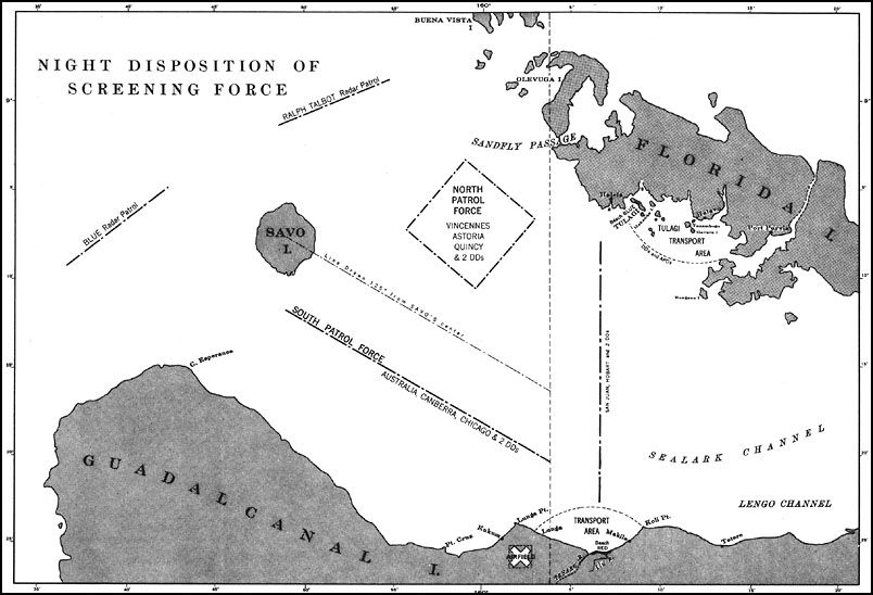
U.S. Navy map from 1943 showing disposition of Allied ships before Battle of Savo Island, August 8-9, 1942. http://www.ibiblio.org/hyperwar/USN/USN-CN-Savo/index.html
[edit] Licensing
| This work is in the public domain in the United States because it is a work of the United States Federal Government under the terms of Title 17, Chapter 1, Section 105 of the US Code. See Copyright.
Note: This only applies to works of the Federal Government and not to the work of any individual U.S. state, territory, commonwealth, county, municipality, or any other subdivision. العربية | Български | Česky | Deutsch | English | Español | Français | Magyar | Italiano | 日本語 | 한국어 | Polski | Português | 中文(繁體) | 中文(简体) | +/- |
 |
File history
Click on a date/time to view the file as it appeared at that time.
| Date/Time | Dimensions | User | Comment | |
|---|---|---|---|---|
| current | 15:34, 26 June 2006 | 804×548 (81 KB) | Cla68 | (U.S. Navy map from 1943 showing disposition of Allied ships before Battle of Savo Island, August 8-9, 1942. http://www.ibiblio.org/hyperwar/USN/USN-CN-Savo/index.html) |
File links
The following pages on the English Wikipedia link to this file (pages on other projects are not listed):

