Image:Satellite image of Falkland Islands in November 1999.jpg
From Wikipedia, the free encyclopedia
No higher resolution available.
Satellite_image_of_Falkland_Islands_in_November_1999.jpg (339 × 230 pixels, file size: 17 KB, MIME type: image/jpeg)
| | This is a file from the Wikimedia Commons. The description on its description page there is shown below.
|
|
|
This file is in the public domain because it was created by NASA. NASA copyright policy states that "NASA material is not protected by copyright unless noted". (NASA copyright policy page or JPL Image Use Policy).
Deutsch | English | Español | Français | Nederlands | Português | Русский | 中文(简体) | 中文(繁體) | +/- |
|
 |
Warnings:
|
| Camera location |
|
Google Maps - Live Maps - Trails.com - TerraServer-USA |
|---|
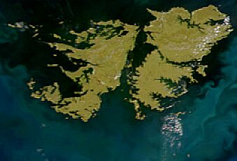
Satellite image of Falkland Islands in November 1999. Cropped image, original taken from NASA's Visible Earth http://visibleearth.nasa.gov/view_rec.php?id=823
File history
Click on a date/time to view the file as it appeared at that time.
| Date/Time | Dimensions | User | Comment | |
|---|---|---|---|---|
| current | 14:13, 7 April 2005 | 339×230 (17 KB) | Hautala | ({{PD-USGov-NASA}} Satellite image of Falkland Islands in November 1999. Cropped image, original taken from NASA's Visible Earth http://visibleearth.nasa.gov/view_rec.php?id=823) |
File links
The following pages on the English Wikipedia link to this file (pages on other projects are not listed):

