Image:Saros county map.jpg
From Wikipedia, the free encyclopedia
Size of this preview: 763 × 600 pixels
Full resolution (2,100 × 1,650 pixels, file size: 499 KB, MIME type: image/jpeg)
| | This is a file from the Wikimedia Commons. The description on its description page there is shown below.
|
| Description |
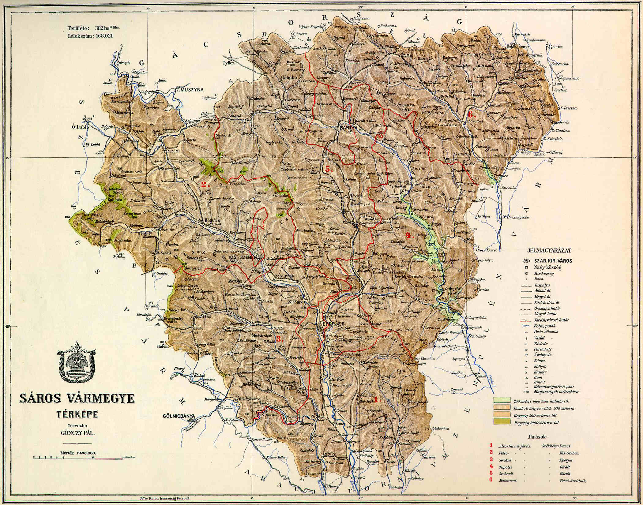
County of Sáros in the pre-Trianon Kingdom of Hungary. |
||
|---|---|---|---|
| Source |
hu:Kép:Sáros vármegye térképe.jpg uploaded by hu:User:Kla |
||
| Date |
not given (1910 - ?) |
||
| Author |
not given (Gönczy Pál - ?) |
||
| Permission (Reusing this image) |
|
File history
Click on a date/time to view the file as it appeared at that time.
| Date/Time | Dimensions | User | Comment | |
|---|---|---|---|---|
| current | 20:14, 10 November 2006 | 2,100×1,650 (499 KB) | PM | ({{Information |Description=County of Sáros in the pre-Trianon Kingdom of Hungary. <br>Komitat Sáros w Królestwie Węgier przed traktatem w Trianon. |Source=hu:Kép:Sáros vármegye térképe.jpg uploaded by hu:User:Kla |Date=not given (1910) |

