Image:SaltGlaciers ZagrosMtns 20010810.jpg
From Wikipedia, the free encyclopedia
Size of this preview: 800 × 509 pixels
Full resolution (1,149 × 731 pixels, file size: 231 KB, MIME type: image/jpeg)
| | This is a file from the Wikimedia Commons. The description on its description page there is shown below.
|
[edit] Summary
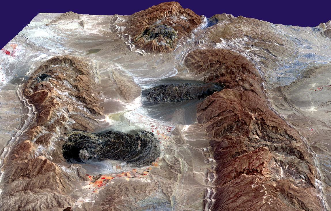
| Description |
Satellite imagery of w:salt domes and w:salt glaciers in the w:Zagros Mountains of southern Iran. This w:ASTER perspective view was created by draping a band 3-2-1 (RGB) image over an ASTER-derived Digital Elevation Model (2x vertical exaggeration). |
|---|---|
| Source |
http://earthobservatory.nasa.gov/Newsroom/NewImages/images.php3?img_id=16435 |
| Date |
August 10, 2001 |
| Author |
NASA/GSFC/MITI/ERSDAC/JAROS, and U.S./Japan ASTER Science Team |
| Permission (Reusing this image) |
US government, public domain |
[edit] Licensing
|
|
This file is in the public domain because it was created by NASA. NASA copyright policy states that "NASA material is not protected by copyright unless noted". (NASA copyright policy page or JPL Image Use Policy).
Deutsch | English | Español | Français | Nederlands | Português | Русский | 中文(简体) | 中文(繁體) | +/- |
|
 |
Warnings:
|
File history
Click on a date/time to view the file as it appeared at that time.
| Date/Time | Dimensions | User | Comment | |
|---|---|---|---|---|
| current | 16:49, 27 April 2006 | 1,149×731 (231 KB) | Howcheng | ({{Information | Description=Satellite imagery of w:salt domes and w:salt glaciers in the w:Zagros Mountains of southern Iran. This w:ASTER perspective view was created by draping a band 3-2-1 (RGB) image over an ASTER-derived Digital Eleva) |
File links
The following pages on the English Wikipedia link to this file (pages on other projects are not listed):

