Image:S-Bahn Rhein Main Map.png
From Wikipedia, the free encyclopedia
Size of this preview: 800 × 600 pixels
Full resolution (1,200 × 900 pixels, file size: 67 KB, MIME type: image/png)
| | This is a file from the Wikimedia Commons. The description on its description page there is shown below.
|
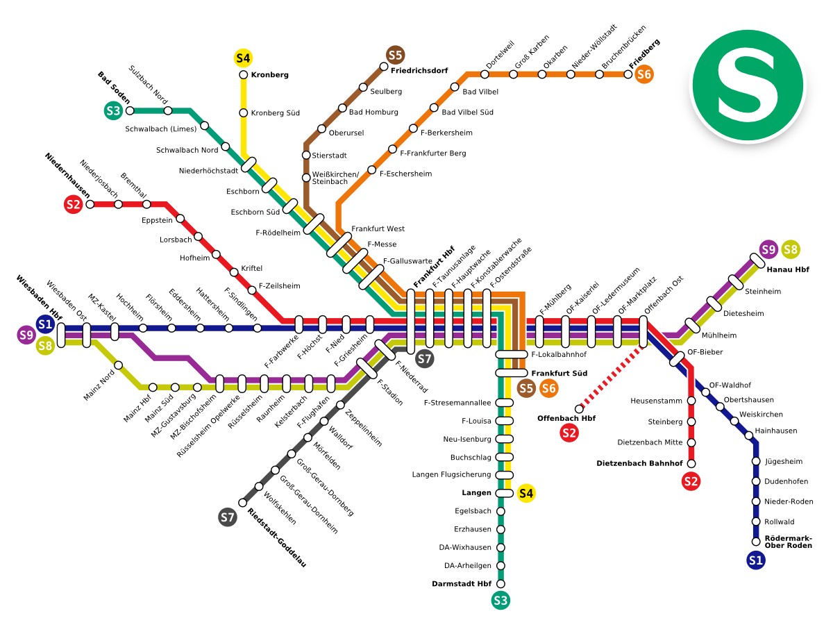
- Description: Map of the s-bahnsystem Rhein-Main
- by reveal (Daniel Erler)
- License: Public Domain
| This image has been (or is hereby) released into the public domain by its author, Reveal at the German Wikipedia project. This applies worldwide. In case this is not legally possible: |
File history
Click on a date/time to view the file as it appeared at that time.
| Date/Time | Dimensions | User | Comment | |
|---|---|---|---|---|
| current | 00:19, 29 September 2005 | 1,200×900 (67 KB) | Dbenzhuser | (added missing station) |
| 18:34, 10 April 2005 | 1,200×900 (66 KB) | Dbenzhuser | (jpeg-artifacts removed) | |
| 13:50, 6 April 2005 | 1,200×900 (149 KB) | Jcornelius | (*Description: Map of the s-bahnsystem Rhein-Main *by reveal (Daniel Erler) *License: Public Domain {{PD}}) |
File links
The following pages on the English Wikipedia link to this file (pages on other projects are not listed):

