Image:Rottnest Island.jpg
From Wikipedia, the free encyclopedia
Size of this preview: 800 × 354 pixels
Full resolution (826 × 366 pixels, file size: 80 KB, MIME type: image/jpeg)
| | This is a file from the Wikimedia Commons. The description on its description page there is shown below.
|
| Description |
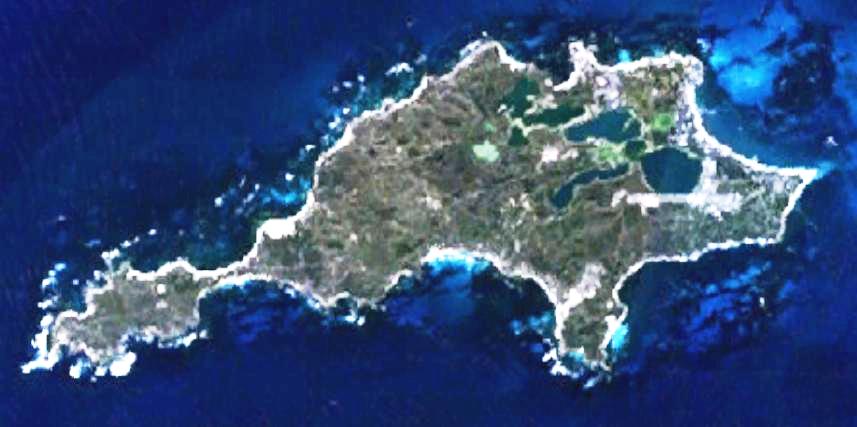
This is a map of the Rottnest Island, Western Australia, made with World Wind using Landsat 7 data. |
|||
|---|---|---|---|---|
| Source | No source specified. Please edit this image description and provide a source. | |||
| Date | ||||
| Author |
Created by the uploader. Any IP involved in the creation of this image is released into the public domain. |
|||
| Permission (Reusing this image) |
|
File history
Click on a date/time to view the file as it appeared at that time.
| Date/Time | Dimensions | User | Comment | |
|---|---|---|---|---|
| current | 02:51, 2 May 2007 | 826×366 (80 KB) | Moondyne | ({{Information |Description=This is a map of the Rottnest Island, Western Australia, made with World Wind using Landsat 7 data. Sharper img |Source= |Date= |Author=Created by the uploader. Any IP involved in the creation of this image is released into the) |
| 01:37, 1 May 2007 | 857×427 (47 KB) | Moondyne | ({{Information |Description=This is a map of the Rottnest Island, Western Australia, made with World Wind using Landsat 7 data. (Adjusted for contrast) |Source= |Date= |Author=Created by the uploader. Any IP involved in the creation of this image is relea) | |
| 03:16, 16 November 2006 | 857×427 (38 KB) | Hesperian | ({{Information |Description=This is a map of the Rottnest Island, Western Australia, made with World Wind using Landsat 7 data. |Source= |Date= |Author=Created by the uploader. Any IP involved in the creation of this image is released into the public domai) |
File links
The following pages on the English Wikipedia link to this file (pages on other projects are not listed):

