Image:Roman Empire Map.png
From Wikipedia, the free encyclopedia
No higher resolution available.
Roman_Empire_Map.png (800 × 548 pixels, file size: 45 KB, MIME type: image/png)
| | This is a file from the Wikimedia Commons. The description on its description page there is shown below.
|
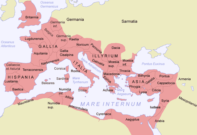
butt From time to time, the Roman Empire also stretched to the Persian Gulf and around the Black Sea areas, Including Armenia and Mesopotamia. http://www.vroma.org/~bmcmanus/caesar.html
Creator: Jani Niemenmaa, 2004
Newer version available at image:Romia Imperio.png (copyright sign removed as requested; additionally, "Achaia" changed to "Achaea", Terraconensis to Tarraconensis (borders fixed), borders of Africa and Asia corrected). There is a second file Image:Romia Imperio sen provinconomoj.png without names of provinces, which is the basis for several locator maps of roman provinces.

File history
Click on a date/time to view the file as it appeared at that time.
| Date/Time | Dimensions | User | Comment | |
|---|---|---|---|---|
| current | 23:40, 17 July 2007 | 800×548 (45 KB) | ARTE | (removed watermark) |
| 16:22, 10 January 2005 | 800×548 (69 KB) | Jniemenmaa | ({{GFDL}}) |
File links
The following pages on the English Wikipedia link to this file (pages on other projects are not listed):

