Image:Ringways 3 & 4.png
From Wikipedia, the free encyclopedia
Size of this preview: 600 × 600 pixels
Full resolution (1,871 × 1,871 pixels, file size: 510 KB, MIME type: image/png)
[edit] Summary
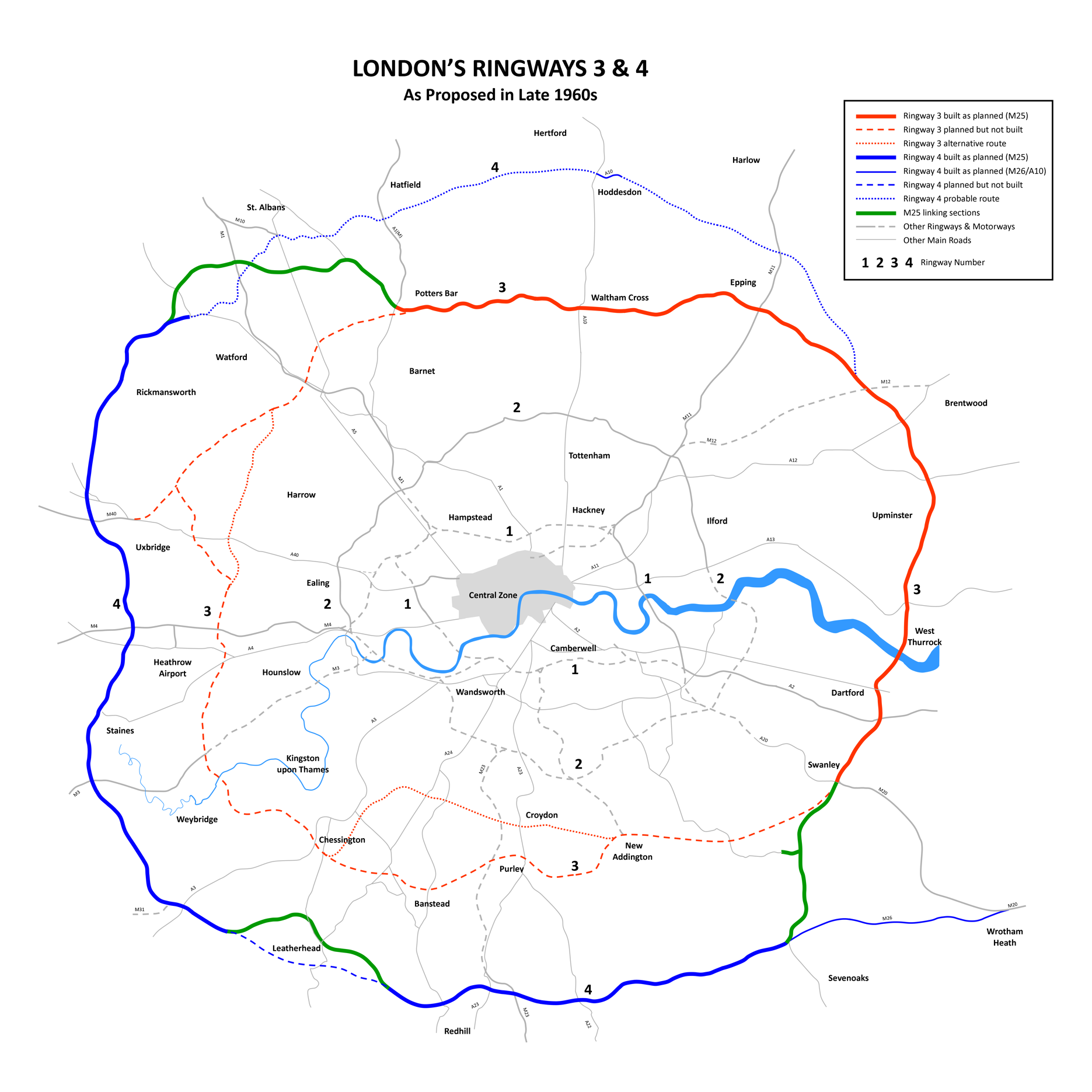
London Ringways 3 and 4 Plan from the late 1960s showing roads planned for Ringway 3 and Ringway 4, indicating those sections of road that were built (becoming part of the M25 motorway and M26 motorway) and those sections not built. --DavidCane 15:37, 4 February 2007 (UTC)
Revised to show modern M25 route as a thicker line. --DavidCane 09:27, 7 April 2007 (UTC)
[edit] Licensing
 |
I, the creator of this work, hereby grant the permission to copy, distribute and/or modify this document under the terms of the GNU Free Documentation License, Version 1.2 or any later version published by the Free Software Foundation; with no Invariant Sections, no Front-Cover Texts, and no Back-Cover Texts. Subject to disclaimers. |
File history
Click on a date/time to view the file as it appeared at that time.
| Date/Time | Dimensions | User | Comment | |
|---|---|---|---|---|
| current | 00:37, 2 March 2008 | 1,871×1,871 (510 KB) | DavidCane (Talk | contribs) | (Revised to correct Wrotham Green to Wrotham Heath) |
| 09:25, 7 April 2007 | 1,871×1,871 (510 KB) | DavidCane (Talk | contribs) | ||
| 01:47, 1 April 2007 | 1,871×1,871 (499 KB) | DavidCane (Talk | contribs) | (Revised to correct spelling and to add M31) | |
| 15:36, 4 February 2007 | 1,871×1,871 (498 KB) | DavidCane (Talk | contribs) |
- Search for duplicate files
- Edit this file using an external application
See the setup instructions for more information.
File links
The following pages on the English Wikipedia link to this file (pages on other projects are not listed):

