Image:Rendeux Luxembourg Belgium Map.png
From Wikipedia, the free encyclopedia
No higher resolution available.
Rendeux_Luxembourg_Belgium_Map.png (220 × 290 pixels, file size: 7 KB, MIME type: image/png)
| | This is a file from the Wikimedia Commons. The description on its description page there is shown below.
|
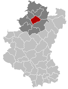
English: Map, municipality Belgium Rendeux
Français : Carte indiquant la localisation de la commune de Rendeux dans la Province de Luxembourg.
| This image has been released into the public domain by its author, LennartBolks. This applies worldwide. In some countries this may not be legally possible; if so: العربية | Български | Deutsch | Ελληνικά | English | Español | Français | Italiano | 日本語 | 한국어 | Polski | Русский | Српски / Srpski | Svenska | தமிழ் | Українська | 中文(繁體) | 中文(简体) +/- |
Originally uploaded to Dutch Wikipedia as nl:Afbeelding:RendeuxLocatie.png. History of uploads:
- 19 aug 2005 20:36 . . Westermarck (Overleg) . . 220x290 (6942 bytes)
- 17 feb 2004 19:35 . . LennartBolks (Overleg) . . 220x290 (5122 bytes) (Gemeentekaart, eigen werk)
File history
Click on a date/time to view the file as it appeared at that time.
| Date/Time | Dimensions | User | Comment | |
|---|---|---|---|---|
| current | 13:19, 20 November 2005 | 220×290 (7 KB) | Srtxg | (arr. in dark) |
| 18:33, 26 February 2005 | 220×290 (5 KB) | Nicnac25 | (Map, municipality belgium Rendeux) |
File links
The following pages on the English Wikipedia link to this file (pages on other projects are not listed):

