Image:Queensland cadastral divisions 1893.png
From Wikipedia, the free encyclopedia
Size of this preview: 455 × 600 pixels
Full resolution (1,672 × 2,203 pixels, file size: 641 KB, MIME type: image/png)
| | This is a file from the Wikimedia Commons. The description on its description page there is shown below.
|
[edit] Summary
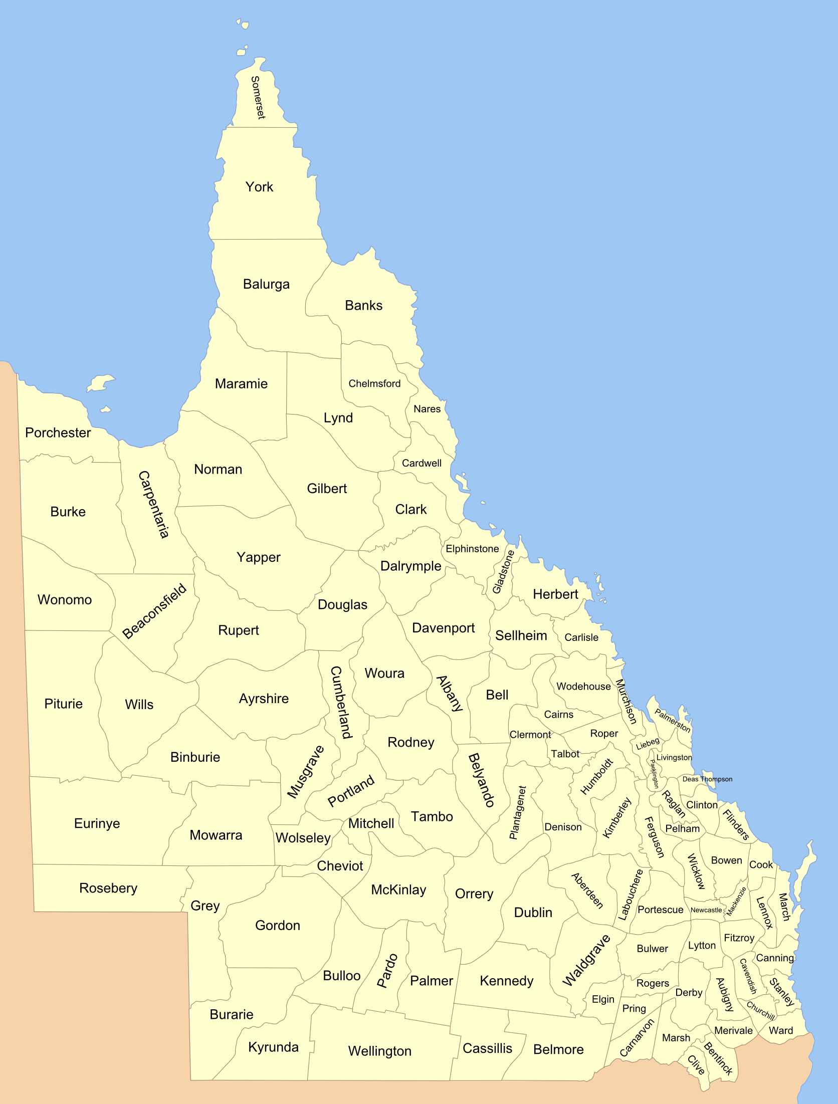
109 Queensland counties in 1893, made from public domain old map in National Library collection. (this is a historic map: these were later subdivided into 322 counties)
[edit] Licensing

File history
Click on a date/time to view the file as it appeared at that time.
| Date/Time | Dimensions | User | Comment | |
|---|---|---|---|---|
| current | 11:46, 8 March 2007 | 1,672×2,203 (641 KB) | Roke | (109 Queensland counties in 1893, made from [http://nla.gov.au/nla.map-t1190 public domain] old map in National Library collection. (this is a historic map: these were later subdivided into 322 counties) Category:Maps of Queensland [[Category:Maps of ) |
File links
The following pages on the English Wikipedia link to this file (pages on other projects are not listed):

