Image:Puerto Rico geography.gif
From Wikipedia, the free encyclopedia

No higher resolution available.
Puerto_Rico_geography.gif (698 × 333 pixels, file size: 28 KB, MIME type: image/gif)
| | This is a file from the Wikimedia Commons. The description on its description page there is shown below.
|
| Description |
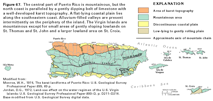
Map of Puerto Rico's geography |
|||
|---|---|---|---|---|
| Source | ||||
| Date | ||||
| Author | ||||
| Permission (Reusing this image) |
|
File history
Click on a date/time to view the file as it appeared at that time.
| Date/Time | Dimensions | User | Comment | |
|---|---|---|---|---|
| current | 01:28, 14 July 2006 | 698×333 (28 KB) | Joelr31 | ({{Information |Description= Map of Puerto Rico's geography |Source=http://capp.water.usgs.gov/gwa/ch_n/gif/N067.gif |Date= |Author= |Permission={{USGS}} |other_versions= }} ) |
File links
The following pages on the English Wikipedia link to this file (pages on other projects are not listed):

