Image:Powder-River-Map.jpg
From Wikipedia, the free encyclopedia
No higher resolution available.
Powder-River-Map.jpg (412 × 444 pixels, file size: 130 KB, MIME type: image/jpeg)
| | This is a file from the Wikimedia Commons. The description on its description page there is shown below.
|
| Description |
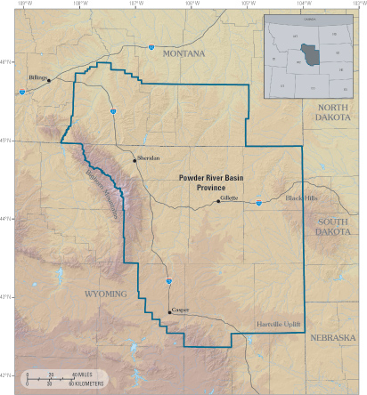
Powder River Basin Province of northeastern Wyoming and southeastern Montana. |
|||
|---|---|---|---|---|
| Source |
http://pubs.usgs.gov/fs/fs-146-02/Powder-River-Map.jpg from http://pubs.usgs.gov/fs/fs-146-02/fs-146-02.html |
|||
| Date |
Unknown |
|||
| Author |
USGS |
|||
| Permission (Reusing this image) |
|
File history
Click on a date/time to view the file as it appeared at that time.
| Date/Time | Dimensions | User | Comment | |
|---|---|---|---|---|
| current | 00:24, 14 May 2007 | 412×444 (130 KB) | Dual Freq | ({{Information |Description=Powder River Basin Province of northeastern Wyoming and southeastern Montana. |Source=http://pubs.usgs.gov/fs/fs-146-02/Powder-River-Map.jpg from http://pubs.usgs.gov/fs/fs-146-02/fs-146-02.html |Date=Unknown |Author=USGS |Permi) |
File links
The following pages on the English Wikipedia link to this file (pages on other projects are not listed):

