Image:Pondicherry map.png
From Wikipedia, the free encyclopedia
Size of this preview: 582 × 600 pixels
Full resolution (2,284 × 2,354 pixels, file size: 1.6 MB, MIME type: image/png)
| | This is a file from the Wikimedia Commons. The description on its description page there is shown below.
|
[edit] Summary
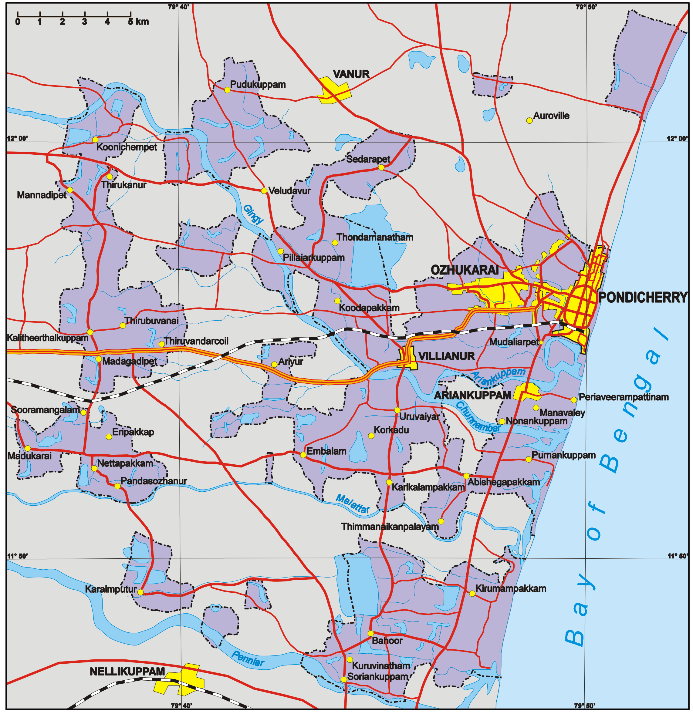
Map of Puducherry Region, Union Territory of Puducherry, India. Author: Aotearoa from Poland
Cette carte existe également en français [[1]].
[edit] Licensing

File history
Click on a date/time to view the file as it appeared at that time.
| Date/Time | Dimensions | User | Comment | |
|---|---|---|---|---|
| current | 16:46, 5 February 2006 | 2,284×2,354 (1.6 MB) | Aotearoa | (Map of Pondicherry Region, Union Territory of Pondicherry, India. Author: Aotearoa from Poland) |
File links
The following pages on the English Wikipedia link to this file (pages on other projects are not listed):


![[1]](http://commons.wikimedia.org/wiki/Image:Pondich%C3%A9ry_Carte.png?uselang=fr|ici)