Image:Political map of Somalia showing Jowhar.png
From Wikipedia, the free encyclopedia
Size of this preview: 499 × 600 pixels
Full resolution (1,405 × 1,689 pixels, file size: 2.32 MB, MIME type: image/png)
| | This is a file from the Wikimedia Commons. The description on its description page there is shown below.
|
[edit] Summary
| Description |
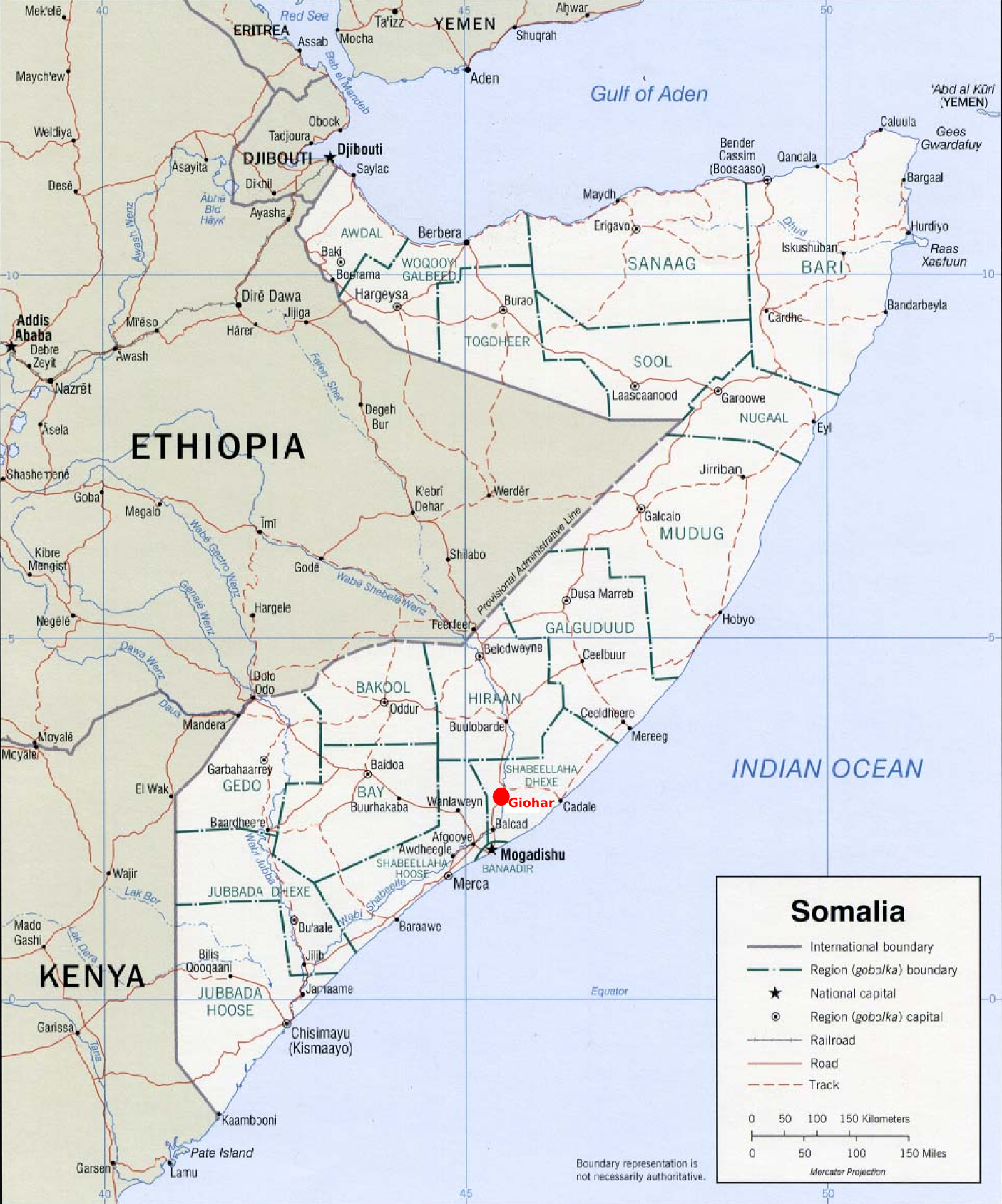
This is a political map of Somalia showing the location of Jowhar (or Giohar) north of Mogadishu with a red dot. |
|---|---|
| Source |
Original political map taken from Renato Caniatti's upload at Image:Somalia_pol02.jpg, which was in turn taken from http://www.lib.utexas.edu/maps/africa/somalia_pol02.jpg. |
| Date |
18 June 2006 |
| Author |
Jeffrey Finkelstein |
| Permission (Reusing this image) |
This derivative work is released into the Public Domain. |
[edit] Licensing
| This work is in the public domain in the United States because it is a work of the United States Federal Government under the terms of Title 17, Chapter 1, Section 105 of the US Code. See Copyright.
Note: This only applies to works of the Federal Government and not to the work of any individual U.S. state, territory, commonwealth, county, municipality, or any other subdivision. العربية | Български | Česky | Deutsch | English | Español | Français | Magyar | Italiano | 日本語 | 한국어 | Polski | Português | 中文(繁體) | 中文(简体) | +/- |
 |
File history
Click on a date/time to view the file as it appeared at that time.
| Date/Time | Dimensions | User | Comment | |
|---|---|---|---|---|
| current | 15:51, 18 June 2006 | 1,405×1,689 (2.32 MB) | J. Finkelstein | ({{Information |Description=This is a political map of Somalia showing the location of Jowhar (or Giohar) north of Mogadishu with a red dot. |Source=Original political map taken from Renato Caniatti's upload at Image:Somalia_pol02.jpg, which was in tu) |

