Image:POLSKA woj pow gminy.png
From Wikipedia, the free encyclopedia
Size of this preview: 646 × 600 pixels
Full resolution (2,041 × 1,895 pixels, file size: 1.6 MB, MIME type: image/png)
| | This is a file from the Wikimedia Commons. The description on its description page there is shown below.
|
[edit] Summary
| Description |
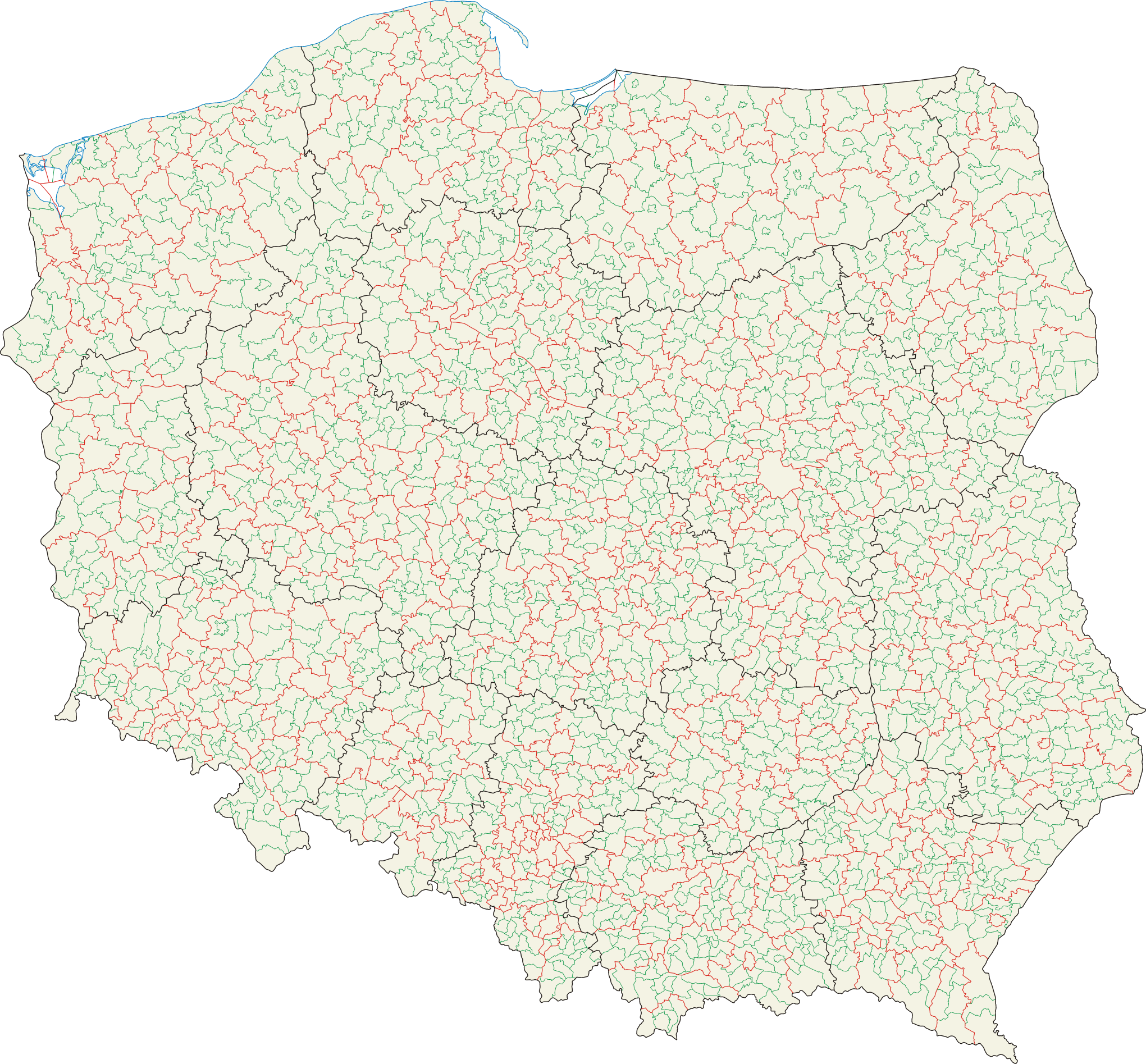
Mapa administracyjna Polski z zaznaczonymi granicami województw (na czarno), powiatów (na czerwono) i gmin (na zielono), stan na 1 stycznia 2008 |
|||
|---|---|---|---|---|
| Source |
Self-made, based on Administrative Map of Poland 1:500.000 published by Head Office of Geodesy and Cartography with actualization |
|||
| Date |
2007-02-01, updated=2008-04-10 |
|||
| Author | ||||
| Permission (Reusing this image) |
|

 |
This map image should be recreated using vector graphics as an SVG file. This has several advantages; see Commons:Media for cleanup for more information. If an SVG form of this image is already available, please upload it. After uploading an SVG, replace this template with template {{Vector version available|new image name.svg}} in this image. |
|
العربية | Български | Català | Česky | Dansk | Deutsch | English | Esperanto | Español | Français | 한국어 | Italiano | Magyar | Lietuvių | Nederlands | 日本語 | Polski | Português | Română | Русский | Suomi | Svenska | Türkçe | Українська | Tiếng Việt | मराठी | 中文(繁體) | 中文(简体) | +/- |
|
File history
Click on a date/time to view the file as it appeared at that time.
| Date/Time | Dimensions | User | Comment | |
|---|---|---|---|---|
| current | 07:20, 10 April 2008 | 2,041×1,895 (1.6 MB) | Aotearoa | |
| 20:35, 5 February 2007 | 2,041×1,895 (1.71 MB) | Aotearoa | ||
| 18:34, 5 February 2007 | 2,041×1,895 (1.73 MB) | Aotearoa | (Mapa administracyjna Polski z zaznaczonymi granicami województw, gmin i powiatów. Autor: Aotearoa<br> Administrative map of Poland with borders of województwa (voivodships), powiaty (counties) and gminy (communes). By [[User:Aotearoa|) |

