Image:Pike Nat Forest vicinity map.jpg
From Wikipedia, the free encyclopedia
No higher resolution available.
Pike_Nat_Forest_vicinity_map.jpg (507 × 430 pixels, file size: 102 KB, MIME type: image/jpeg)
| | This is a file from the Wikimedia Commons. The description on its description page there is shown below.
|
[edit] Summary
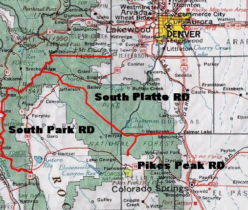
A map of the Pike National Forest. Sourced from this image, the picture was found on this U.S.D.A. Forest Service web site.
[edit] Licensing
| This work is in the public domain in the United States because it is a work of the United States Federal Government under the terms of Title 17, Chapter 1, Section 105 of the US Code. See Copyright.
Note: This only applies to works of the Federal Government and not to the work of any individual U.S. state, territory, commonwealth, county, municipality, or any other subdivision. العربية | Български | Česky | Deutsch | English | Español | Français | Magyar | Italiano | 日本語 | 한국어 | Polski | Português | 中文(繁體) | 中文(简体) | +/- |
 |
File history
Click on a date/time to view the file as it appeared at that time.
| Date/Time | Dimensions | User | Comment | |
|---|---|---|---|---|
| current | 21:55, 23 July 2007 | 507×430 (102 KB) | Ken g6 | (A map of the Pike National Forest. Sourced from [http://www.fs.fed.us/r2/psicc/maps/pike_vicinity.jpg this image], the picture was found on [http://www.fs.fed.us/r2/psicc/maps/pike.shtml this U.S.D.A. Forest Service web site].) |
File links
The following pages on the English Wikipedia link to this file (pages on other projects are not listed):

