Image:PigWar-boundaries.png
From Wikipedia, the free encyclopedia
No higher resolution available.
PigWar-boundaries.png (384 × 309 pixels, file size: 60 KB, MIME type: image/png)
| | This is a file from the Wikimedia Commons. The description on its description page there is shown below.
|
[edit] Summary
| Description |
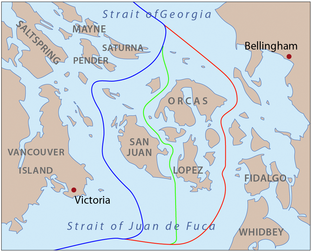
This is a map of the proposed boundaries between the United States and Canada around the San Juan Islands, for use in describing the Pig War. I, Pfly, made it with ArcGIS, Adobe Illustrator, and Adobe Photoshop. |
|---|---|
| Source |
self-made, information one boundaries from Hayes, Derek, Historical Atlas of the Pacific Northwest. |
| Date |
May 15, 2008 |
| Author | |
| Permission (Reusing this image) |
see below |
[edit] Licensing
|

File history
Click on a date/time to view the file as it appeared at that time.
| Date/Time | Dimensions | User | Comment | |
|---|---|---|---|---|
| current | 01:31, 16 May 2008 | 384×309 (60 KB) | Pfly | ({{Information |Description=This is a map of the proposed boundaries between the United States and Canada around the San Juan Islands, for use in describing the Pig War. I, Pfly, made it with [[:en) |
File links
The following pages on the English Wikipedia link to this file (pages on other projects are not listed):

