Image:Philadelphia Transit and Commuter Rail System.png
From Wikipedia, the free encyclopedia
Size of this preview: 800 × 568 pixels
Full resolution (2,016 × 1,431 pixels, file size: 142 KB, MIME type: image/png)
| | This is a file from the Wikimedia Commons. The description on its description page there is shown below.
|
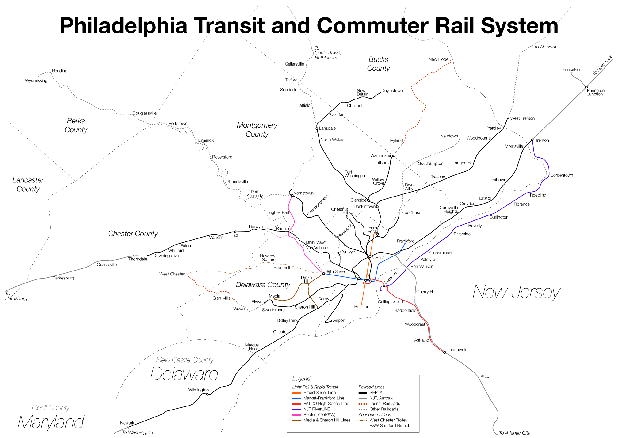
Description: Geographic map of Philadelphia region rail system.
Source: self-made
Date: 2005-08-19
Author: Lucius Kwok
Permission:
| This file is licensed under Creative Commons Attribution 2.5 License In short: you are free to distribute and modify the file as long as you attribute its author(s) or licensor(s). |
Other versions of this file: None
File history
Click on a date/time to view the file as it appeared at that time.
| Date/Time | Dimensions | User | Comment | |
|---|---|---|---|---|
| current | 05:13, 21 August 2005 | 2,016×1,431 (142 KB) | Luciuskwok | ('''Description:''' Geographic map of Philadelphia region rail system. '''Source:''' self-made '''Date:''' 2005-08-19 '''Author:''' Lucius Kwok '''Permission:''' {{cc-by-2.5}} '''Other versions of this file:''' None) |
File links
The following pages on the English Wikipedia link to this file (pages on other projects are not listed):

