Image:Ph bukidnon dangcagan political map.png
From Wikipedia, the free encyclopedia
Size of this preview: 800 × 410 pixels
Full resolution (3,183 × 1,631 pixels, file size: 647 KB, MIME type: image/png)
| | This is a file from the Wikimedia Commons. The description on its description page there is shown below.
|
[edit] Summary
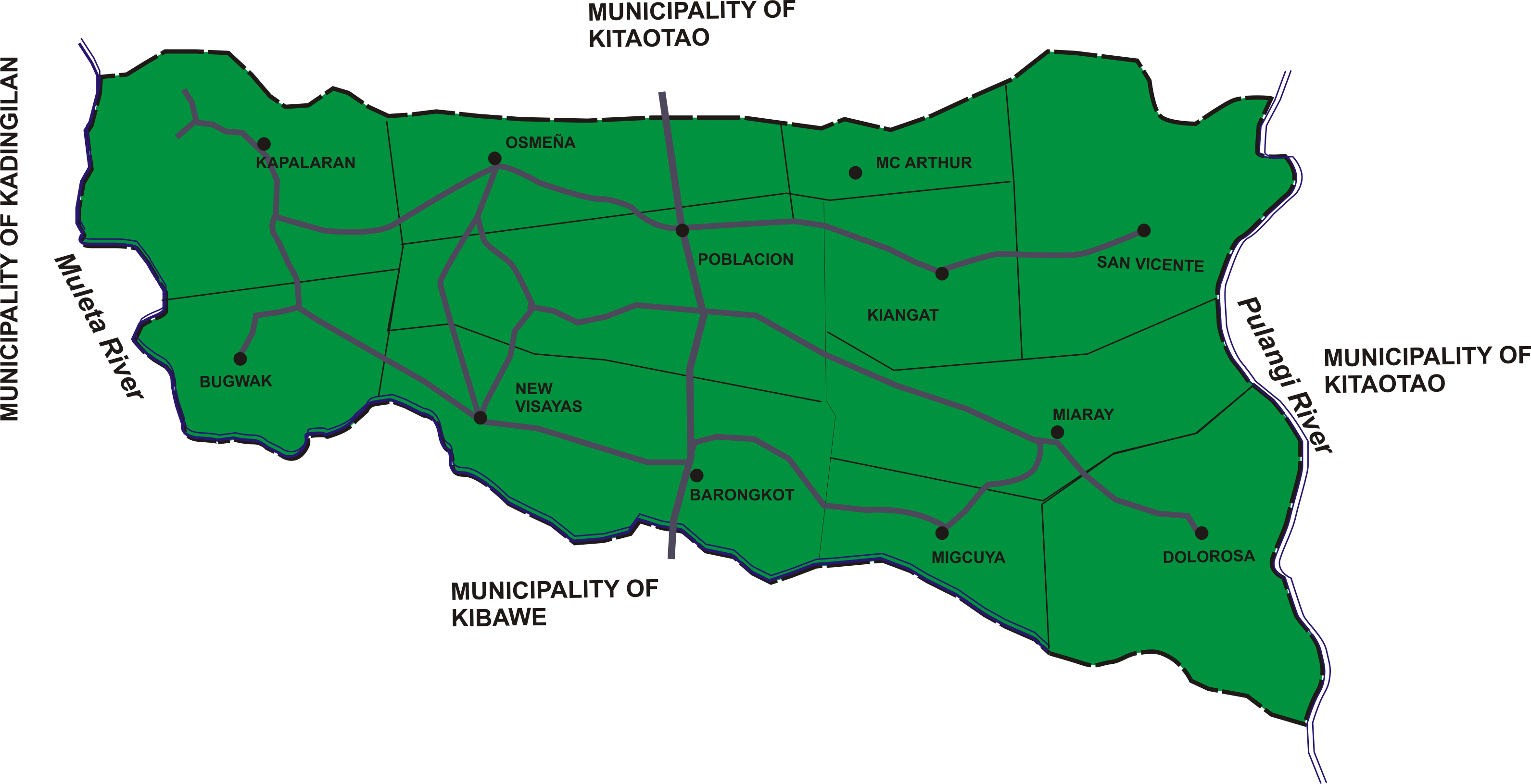
| Description |
Political map of Dangcagan, Bukidnon |
|---|---|
| Source |
self-made |
| Date |
January 28, 2008 |
| Author | |
| Permission (Reusing this image) |
see below |
[edit] Licensing

File history
Click on a date/time to view the file as it appeared at that time.
| Date/Time | Dimensions | User | Comment | |
|---|---|---|---|---|
| current | 11:12, 28 January 2008 | 3,183×1,631 (647 KB) | Kleomarlo | ({{Information |Description=Political map of Dangcagan, Bukidnon |Source=self-made |Date=January 28, 2008 |Author= Kleomarlo |Permission= |other_versions= }} ) |
File links
The following pages on the English Wikipedia link to this file (pages on other projects are not listed):

