Image:Pervouralsk map.jpg
From Wikipedia, the free encyclopedia
No higher resolution available.
Pervouralsk_map.jpg (300 × 300 pixels, file size: 28 KB, MIME type: image/jpeg)
| | This is a file from the Wikimedia Commons. The description on its description page there is shown below.
|
[edit] Summary
Original description:
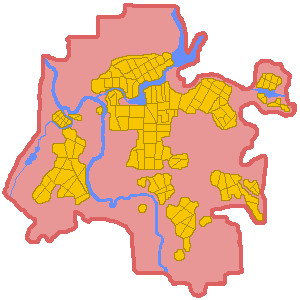
Description: Map of Pervouralsk City
Source: self-made
Date: created 4. Dec. 2004
Author: Komissarova Nadezhda
Permission: GFDL (self made)
Other versions of this file: avaliable on request
From: en:Image:Pervouralsk map.jpg by en:User talk:Nadezhda Komissarova (no userpage exists at moment of upload)
[edit] Licensing
 |
Permission is granted to copy, distribute and/or modify this document under the terms of the GNU Free Documentation License, Version 1.2 or any later version published by the Free Software Foundation; with no Invariant Sections, no Front-Cover Texts, and no Back-Cover Texts. Subject to disclaimers. Asturianu | Български | Català | Deutsch | English | Español | Français | Gaeilge | Italiano | 한국어 | 日本語 | Polski | Português | Română | Türkçe | +/- |
File history
Click on a date/time to view the file as it appeared at that time.
| Date/Time | Dimensions | User | Comment | |
|---|---|---|---|---|
| current | 10:54, 3 March 2006 | 300×300 (28 KB) | Hardscarf | (Original description:<br> Description: Map of Pervouralsk City Source: self-made Date: created 4. Dec. 2004 Author: Komissarova Nadezhda Permission: GFDL (self made) Other versions of this file: avaliable on request From: [[:en:Image:Pervouralsk ma) |
File links
Metadata
This file contains additional information, probably added from the digital camera or scanner used to create or digitize it. If the file has been modified from its original state, some details may not fully reflect the modified file.
| Orientation | Normal |
|---|---|
| Software used | ACD Systems Digital Imaging |
| File change date and time | 18:18, 2 March 2006 |
| Y and C positioning | 1 |
| Exif version | 2.2 |
| DateTime subseconds | 265 |

