Image:Passaic County, NJ municipalities labeled.png
From Wikipedia, the free encyclopedia
Size of this preview: 424 × 600 pixels
Full resolution (2,048 × 2,896 pixels, file size: 330 KB, MIME type: image/png)
| | This is a file from the Wikimedia Commons. The description on its description page there is shown below.
|
[edit] Summary
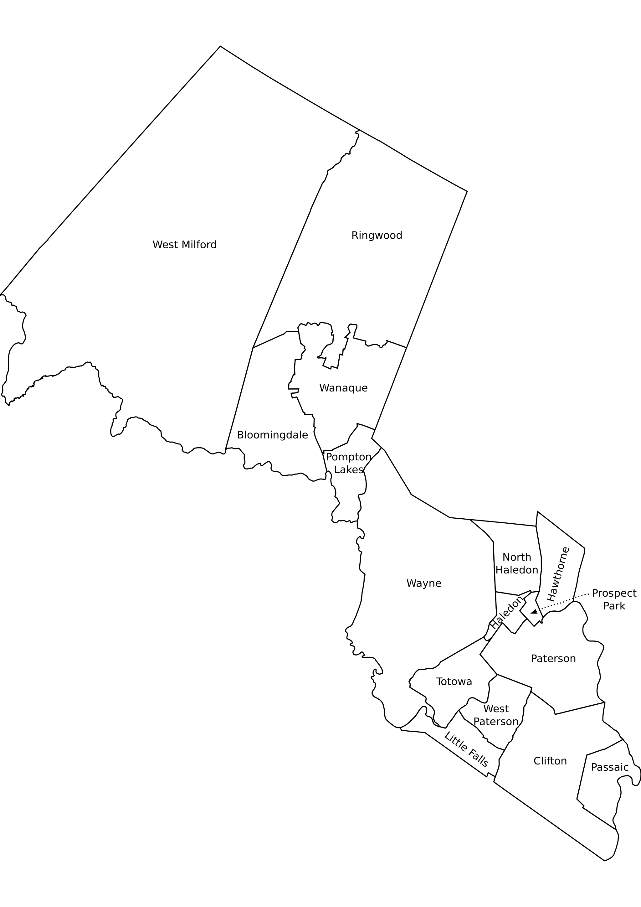
Passaic County, New Jersey outline map of municipalities, labeled.
Sources:
- NJDEP publishes Arcview shape format outline maps of counties and municpalities. Believed ((PD-ineligible)). [1]
- Converted to SVG, edited in inkscape
- Labeled according to [2]
SVG source: Image:Passaic County, NJ municipalities labeled.svg
[edit] Licensing
| I, the copyright holder of this work, hereby release it into the public domain. This applies worldwide. In case this is not legally possible: Afrikaans | Alemannisch | Aragonés | العربية | Asturianu | Български | Català | Česky | Cymraeg | Dansk | Deutsch | Eʋegbe | Ελληνικά | English | Español | Esperanto | Euskara | Estremeñu | فارسی | Français | Galego | 한국어 | हिन्दी | Hrvatski | Ido | Bahasa Indonesia | Íslenska | Italiano | עברית | Kurdî / كوردی | Latina | Lietuvių | Latviešu | Magyar | Македонски | Bahasa Melayu | Nederlands | Norsk (bokmål) | Norsk (nynorsk) | 日本語 | Polski | Português | Ripoarisch | Română | Русский | Shqip | Slovenčina | Slovenščina | Српски / Srpski | Svenska | ไทย | Tagalog | Türkçe | Українська | Tiếng Việt | Walon | 中文(简体) | 中文(繁體) | zh-yue-hant | +/- |
File history
Click on a date/time to view the file as it appeared at that time.
| Date/Time | Dimensions | User | Comment | |
|---|---|---|---|---|
| current | 21:50, 28 November 2005 | 2,048×2,896 (330 KB) | ChrisRuvolo | (Passaic County, New Jersey outline map of municipalities, labeled. Sources: * NJDEP publishes Arcview shape format outline maps of counties and municpalities. Believed ((PD-ineligible)). [http://www.state.nj.us/dep/gis/munshp.html] * Converted to SVG, e) |

