Image:Panoramic Map Detail, Farmington, NH.jpg
From Wikipedia, the free encyclopedia
No higher resolution available.
Panoramic_Map_Detail,_Farmington,_NH.jpg (316 × 349 pixels, file size: 41 KB, MIME type: image/jpeg)
| | This is a file from the Wikimedia Commons. The description on its description page there is shown below.
|
| Description |
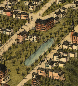
Bird's-eye View of Farmington, NH; detail from an 1877 panoramic map. |
|---|---|
| Source |
Originally from en.wikipedia; description page is/was here. |
| Date |
2006-06-29 (original upload date) |
| Author |
Original uploader was Hugh Manatee at en.wikipedia |
| Permission (Reusing this image) |
PD-ART. |
[edit] License information
This photographic reproduction is therefore also in the public domain. العربية | Česky | Deutsch | English | Ελληνικά | Español | فارسی | Français | עברית | Bahasa Indonesia | Italiano | 日本語 | 한국어 | Magyar | Nederlands | Polski | Português | Română | Русский | Slovenščina | Српски / Srpski | Basa Sunda | Türkçe | Українська | 中文(繁體) | 中文(简体) | +/- |
[edit] Original upload log
(All user names refer to en.wikipedia)
- 2006-06-29 21:13 Hugh Manatee 316×349×8 (42074 bytes) Bird's-eye View of Farmington, NH; detail from an 1877 panoramic map.
File history
Click on a date/time to view the file as it appeared at that time.
| Date/Time | Dimensions | User | Comment | |
|---|---|---|---|---|
| current | 19:48, 17 June 2007 | 316×349 (41 KB) | Finnrind | ({{Information |Description=Bird's-eye View of Farmington, NH; detail from an 1877 panoramic map. |Source=Originally from [http://en.wikipedia.org en.wikipedia]; description page is/was [http://en.wikipedia.org/w/index.php?title=Image%3APanoramic_Map_Deta) |

