Image:Panama-canal-shepherd-elevation.png
From Wikipedia, the free encyclopedia
Size of this preview: 800 × 219 pixels
Full resolution (2,091 × 573 pixels, file size: 2.51 MB, MIME type: image/png)
| | This is a file from the Wikimedia Commons. The description on its description page there is shown below.
|
| Description |
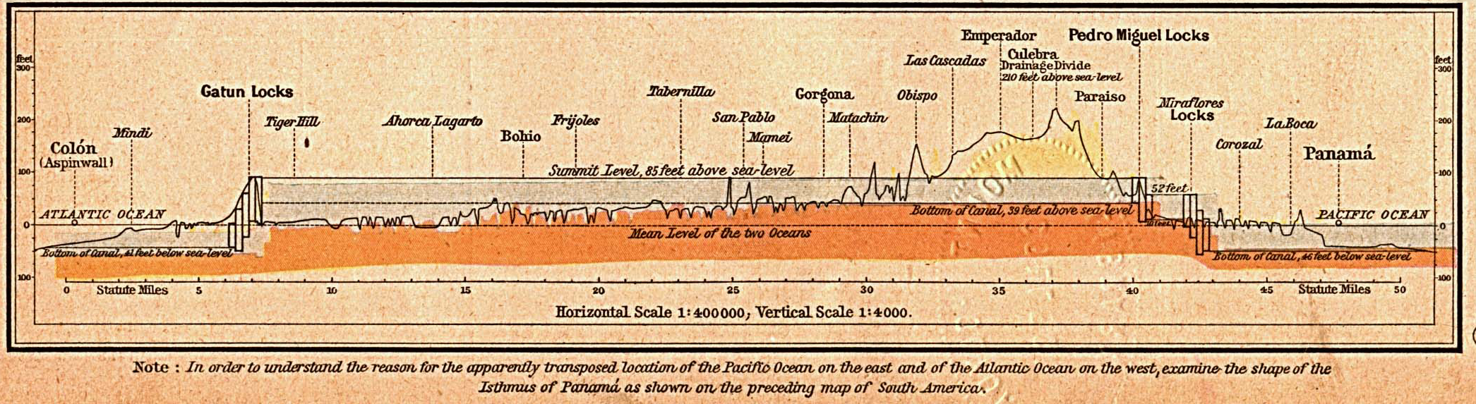
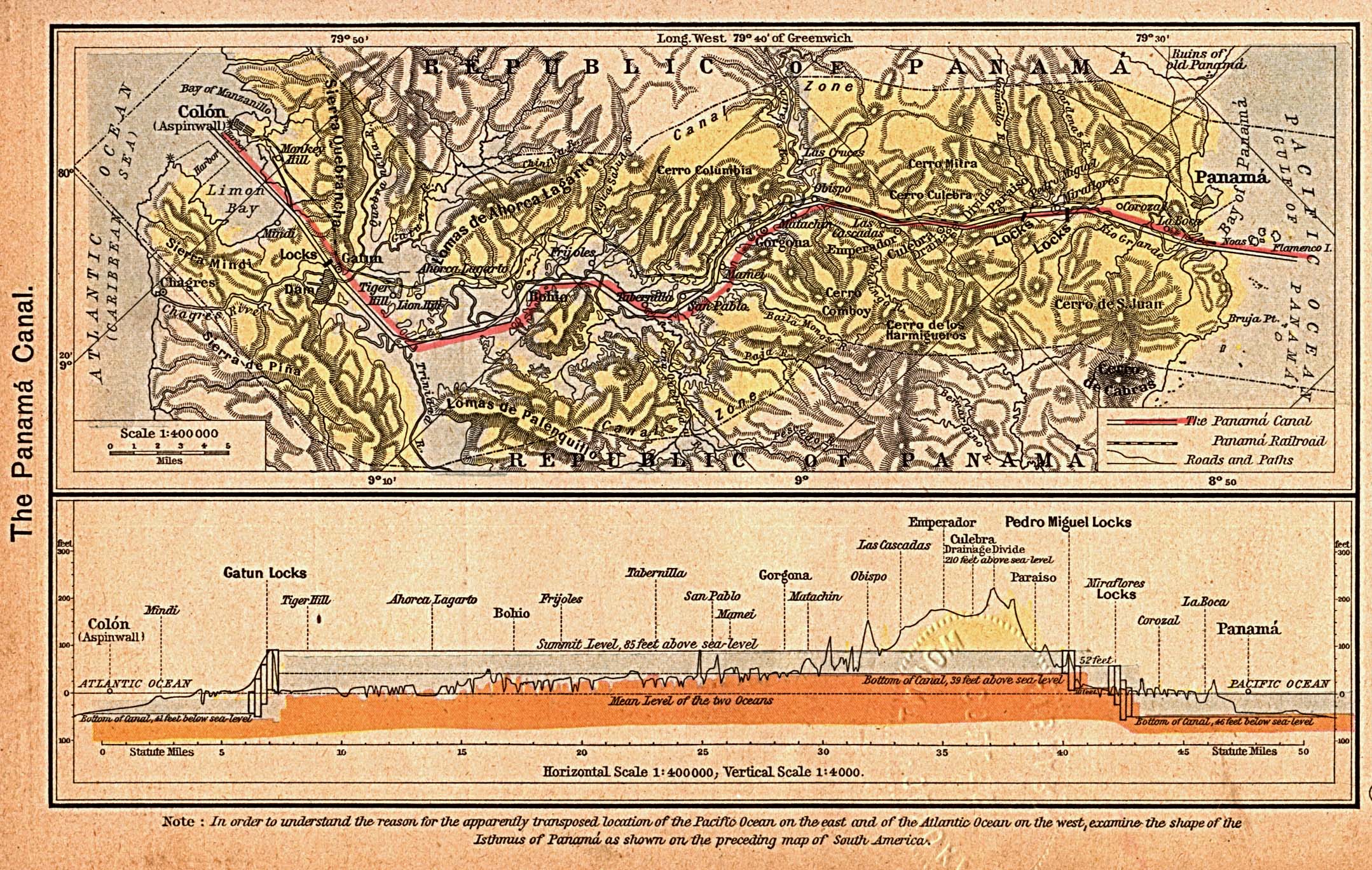
Panama canal |
|---|---|
| Source |
|
| Date |
1923 |
| Author |
William R. Shepherd |
| Permission (Reusing this image) |
see below |
|
|
This media file is in the public domain in the United States. This applies to U.S. works where the copyright has expired, often because its first publication occurred prior to January 1, 1923. See this page for further explanation.
|
|
|
Deutsch | English | Español | Français | Gaeilge | Galego | Italiano | Nederlands | 中文(简体) | +/- |
||
|
|
This image might not be in the public domain outside of the United States (this especially applies in Canada, China (not Hong Kong, Macao, or Taiwan Area), Germany, Mexico, and Switzerland). The creator and year of publication are essential information and must be provided. See Wikipedia:Public domain and Wikipedia:Copyrights for more details. |
File history
Click on a date/time to view the file as it appeared at that time.
| Date/Time | Dimensions | User | Comment | |
|---|---|---|---|---|
| current | 11:04, 21 May 2006 | 2,091×573 (2.51 MB) | Korrigan | (== Summary == '''BOOK SOURCE:''' "Historical Atlas" by William R. Shepherd, New York, Henry Holt and Company, 1923<br> '''ONLINE SOURCE:''' University of Texas Perry-Casteneda Map Collection, http://www.lib.utexas.edu/maps/historical/history_shepherd_1923) |
File links
The following pages on the English Wikipedia link to this file (pages on other projects are not listed):

