Image:Pacific-Ocean-Pitcairn-Island-on-globe-view-English.jpg
From Wikipedia, the free encyclopedia
No higher resolution available.
Pacific-Ocean-Pitcairn-Island-on-globe-view-English.jpg (400 × 400 pixels, file size: 20 KB, MIME type: image/jpeg)
| | This is a file from the Wikimedia Commons. The description on its description page there is shown below.
|
[edit] Summary
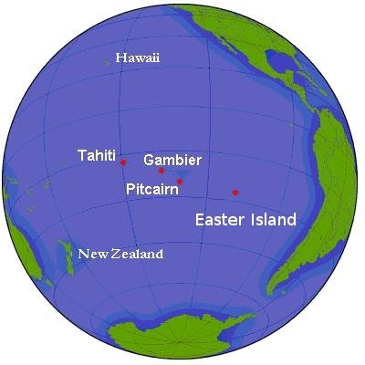
Simple map of globe, seen from area of Pitcairn Island and Tahiti. Ocean waters along continental shelves are shaded in darker hue. Parallels of latitude are at 20-degree intervals. Labels are in English.
Source URL (Wikimedia Commons): http://upload.wikimedia.org/wikipedia/commons/2/2c/Pitcairn.png (file downloaded, cropped, and re-labeled in larger font, as JPEG format, 10x times faster than PNG format).
This file, in JPEG-format, is intended for use in frequently-read articles (might display 20x times faster than larger PNG-format file, and with large, clear labels).
[edit] Licensing

File history
Click on a date/time to view the file as it appeared at that time.
| Date/Time | Dimensions | User | Comment | |
|---|---|---|---|---|
| current | 19:22, 19 January 2007 | 400×400 (20 KB) | Wikid77 | (Simple map of globe, seen from area of Pitcairn Island and Tahiti. Ocean waters along continental shelves are shaded in darker hue. Parallels of latitude are at 20-degree intervals. Labels are in Engl) |
File links
The following pages on the English Wikipedia link to this file (pages on other projects are not listed):

