Image:Oregoncountry.png
From Wikipedia, the free encyclopedia
No higher resolution available.
Oregoncountry.png (593 × 600 pixels, file size: 139 KB, MIME type: image/png)
| | This is a file from the Wikimedia Commons. The description on its description page there is shown below.
|
[edit] Summary
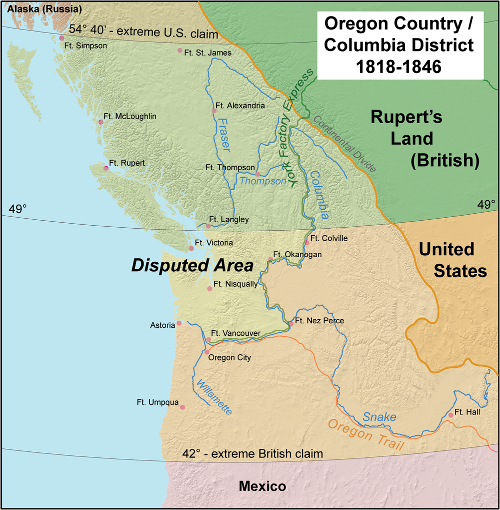
This map shows en:Oregon Country and the border dispute between the U.S. and Britain, 1818-1846.
[edit] Licensing
|
File history
Click on a date/time to view the file as it appeared at that time.
| Date/Time | Dimensions | User | Comment | |
|---|---|---|---|---|
| current | 12:41, 10 April 2006 | 593×600 (139 KB) | Kmusser | |
| 17:58, 6 April 2006 | 593×600 (139 KB) | Kmusser | ||
| 16:52, 6 April 2006 | 593×600 (135 KB) | Kmusser | ||
| 18:27, 5 April 2006 | 593×600 (135 KB) | Kmusser | ||
| 16:53, 5 April 2006 | 593×600 (135 KB) | Kmusser | ||
| 16:24, 5 April 2006 | 593×600 (135 KB) | Kmusser | (This map shows Oregon Country and the border dispute between the U.S. and Britain, 1818-1846. ) |
File links
The following pages on the English Wikipedia link to this file (pages on other projects are not listed):

