Image:Ometepemap.png
From Wikipedia, the free encyclopedia
No higher resolution available.
Ometepemap.png (511 × 465 pixels, file size: 12 KB, MIME type: image/png)
| | This is a file from the Wikimedia Commons. The description on its description page there is shown below.
|
Contents |
[edit] Summary
[edit] Summary
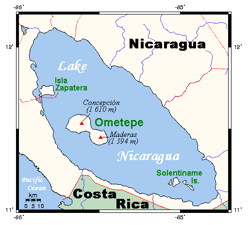
Map showing Ometepe in Lake Nicaragua. This map's source is here, with the uploader's modifications, and the GMT homepage says that the tools are released under the GNU General Public License.
From Wikipedia en
[edit] Licensing
[edit] Licensing
 |
Permission is granted to copy, distribute and/or modify this document under the terms of the GNU Free Documentation License, Version 1.2 or any later version published by the Free Software Foundation; with no Invariant Sections, no Front-Cover Texts, and no Back-Cover Texts. Subject to disclaimers. Asturianu | Български | Català | Deutsch | English | Español | Français | Gaeilge | Italiano | 한국어 | 日本語 | Polski | Português | Română | Türkçe | +/- |
File history
Click on a date/time to view the file as it appeared at that time.
| Date/Time | Dimensions | User | Comment | |
|---|---|---|---|---|
| current | 23:05, 4 February 2007 | 511×465 (12 KB) | TCY | (== Summary == Map showing Ometepe in Lake Nicaragua. This map's source is [http://www.aquarius.geomar.de/omc/make_map.html here], with the uploader's modifications, and the [http://gmt.soest.hawaii.edu/ GMT homepage] says that the tools are released under) |
File links
The following pages on the English Wikipedia link to this file (pages on other projects are not listed):

