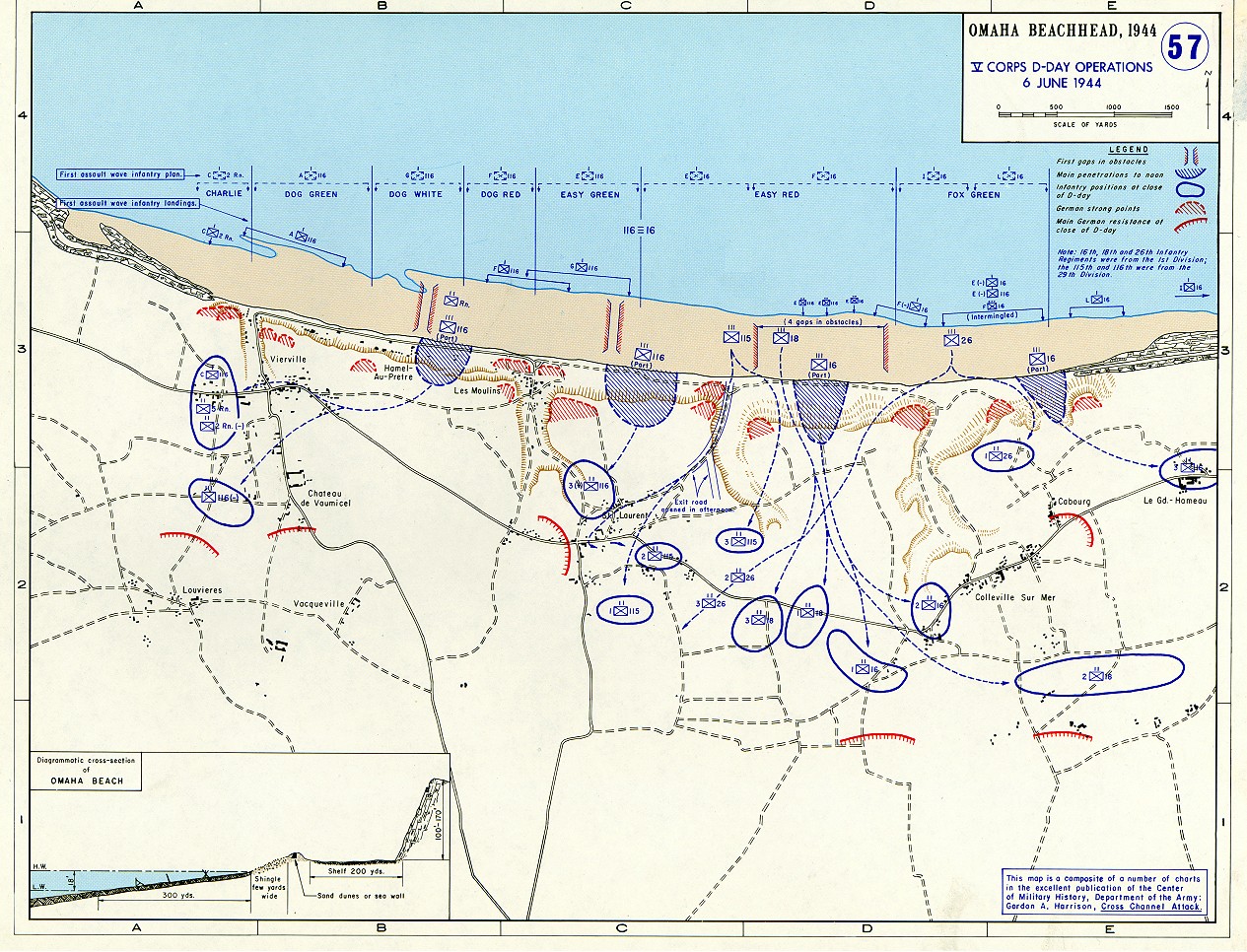
Image:Omaha beachhead 6 June 1944.jpg
From Wikipedia, the free encyclopedia
Size of this preview: 785 × 599 pixels
Full resolution (1,265 × 966 pixels, file size: 449 KB, MIME type: image/jpeg)
| | This is a file from the Wikimedia Commons. The description on its description page there is shown below.
|
| Description |
Omaha beachhead 6 June 1944 In keeping abreast with today's technology, the Department of History is providing these maps on the internet as part of the department's outreach program. The maps were created by the United States Military Academy’s Department of History and are the digital versions from the atlases printed by the United States Defense Printing Agency. We gratefully acknowledge the accomplishments of the department's former cartographer, Mr. Edward J. Krasnoborski, along with the works of our present cartographer, Mr. Frank Martini. Please be aware that these maps are large in file size and may require substantial download times. |
|||
|---|---|---|---|---|
| Source | ||||
| Date | ||||
| Author |
United States Military Academy’s Department of History |
|||
| Permission (Reusing this image) |
|
|||
| Other versions | Image:Omaha beach cross section.jpg (crop of cross-section at bottom left) |

File history
Click on a date/time to view the file as it appeared at that time.
| Date/Time | Dimensions | User | Comment | |
|---|---|---|---|---|
| current | 09:22, 2 June 2005 | 1,265×966 (449 KB) | W.wolny |

