Image:Old map 1807 plan.jpg
From Wikipedia, the free encyclopedia
Size of this preview: 419 × 599 pixels
Full resolution (655 × 937 pixels, file size: 146 KB, MIME type: image/jpeg)
| | This is a file from the Wikimedia Commons. The description on its description page there is shown below.
|
[edit] Summary
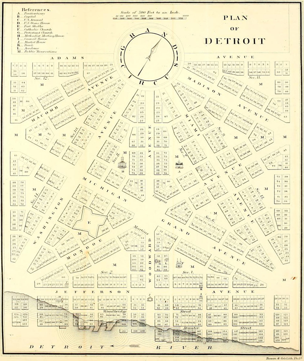
Detroit city layout circa 1807 following the 1805 fire that destroyed most of the city. From the Detroit Historical Museum site
[edit] Licensing
|
|
This media file is in the public domain in the United States. This applies to U.S. works where the copyright has expired, often because its first publication occurred prior to January 1, 1923. See this page for further explanation.
|
|
|
Deutsch | English | Español | Français | Gaeilge | Galego | Italiano | Nederlands | 中文(简体) | +/- |
||
|
|
This image might not be in the public domain outside of the United States (this especially applies in Canada, China (not Hong Kong, Macao, or Taiwan Area), Germany, Mexico, and Switzerland). The creator and year of publication are essential information and must be provided. See Wikipedia:Public domain and Wikipedia:Copyrights for more details. |
File history
Click on a date/time to view the file as it appeared at that time.
| Date/Time | Dimensions | User | Comment | |
|---|---|---|---|---|
| current | 14:54, 8 July 2007 | 655×937 (146 KB) | DeltaWeb | (== Summary == Detroit city layout circa 1807 following the 1805 fire that destroyed most of the city. From the Detroit Historical Museum site == Licensing == {{PD-US}} Category:Michigan maps Category:Images of Detroit, Michigan [[Category:Images ) |
File links
The following pages on the English Wikipedia link to this file (pages on other projects are not listed):

