Image:Okarivermap.png
From Wikipedia, the free encyclopedia
No higher resolution available.
Okarivermap.png (500 × 500 pixels, file size: 153 KB, MIME type: image/png)
| | This is a file from the Wikimedia Commons. The description on its description page there is shown below.
|
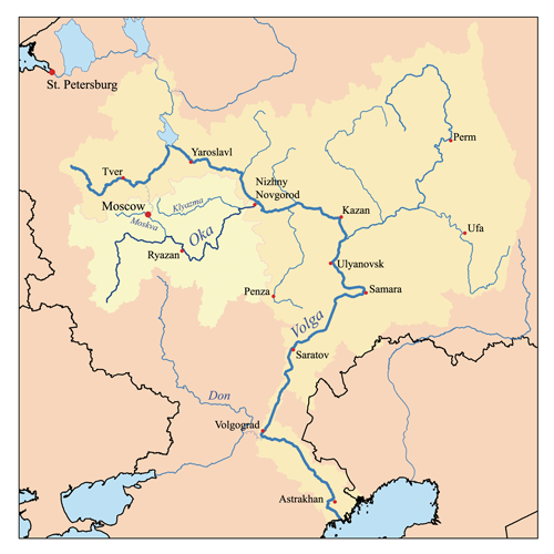
This is a map of the Volga River system with the Oka River highlighted. I, Karl Musser, created it based on USGS data.
|
File history
Click on a date/time to view the file as it appeared at that time.
| Date/Time | Dimensions | User | Comment | |
|---|---|---|---|---|
| current | 17:08, 23 July 2007 | 500×500 (153 KB) | Kmusser | (Ural river fix) |
| 14:49, 17 October 2006 | 500×500 (38 KB) | Kmusser | ||
| 19:03, 14 September 2006 | 500×500 (38 KB) | Kmusser | (This is a map of the Volga River system with the Oka River highlighted. I, Karl Musser, created it based on USGS data. {{self|cc-by-sa-2.5}} Category:Maps of rivers) |
File links
The following pages on the English Wikipedia link to this file (pages on other projects are not listed):

