Image:NZTerritorialAuthorities.png
From Wikipedia, the free encyclopedia
Size of this preview: 458 × 600 pixels
Full resolution (872 × 1,142 pixels, file size: 68 KB, MIME type: image/png)
| | This is a file from the Wikimedia Commons. The description on its description page there is shown below.
|
[edit] Summary
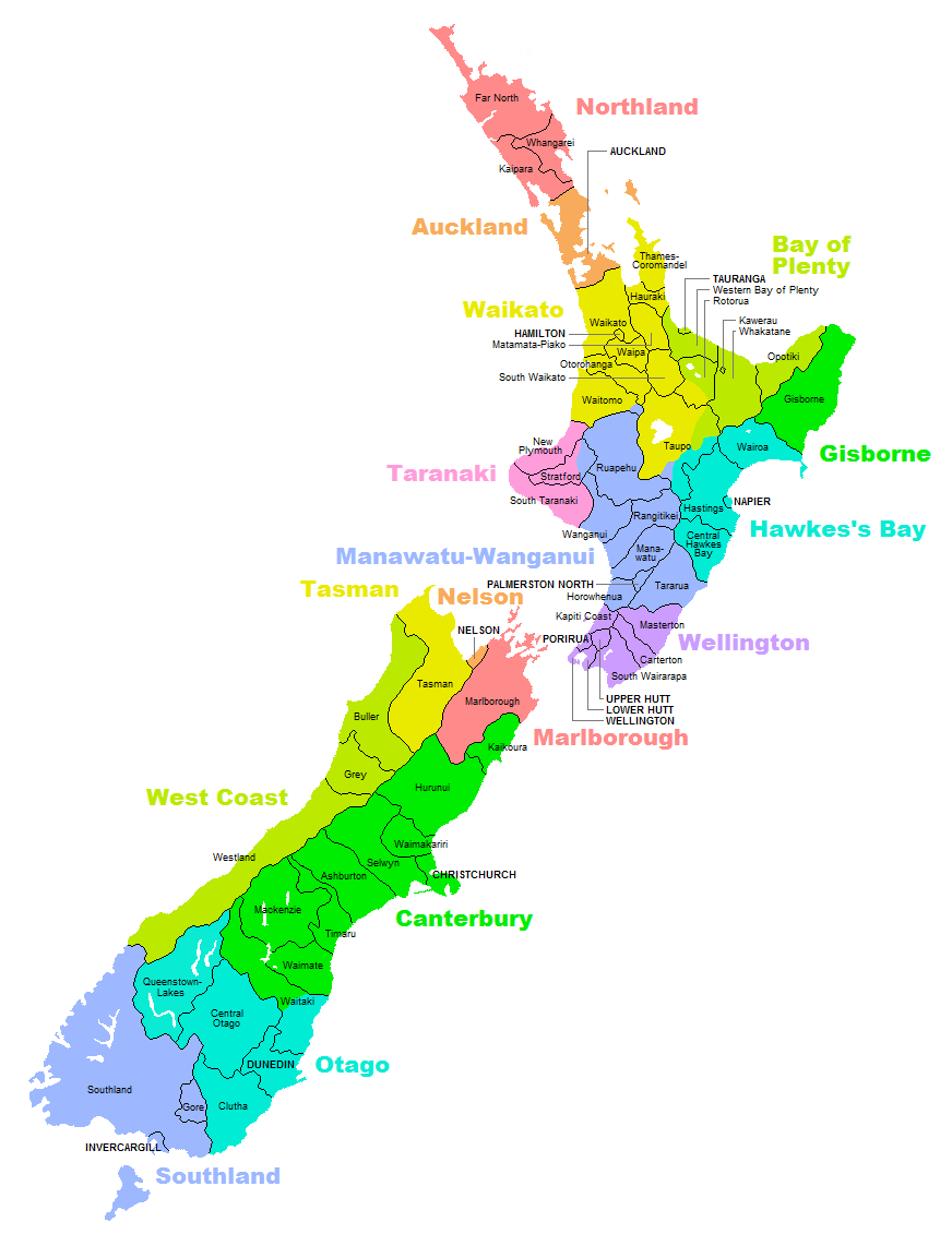
| Description |
Map of territorial authorities (regions, districts, municipalities, etc) in New Zealand |
|---|---|
| Source |
Self-made |
| Date |
23 September 2007 |
| Author |
Uploader |
| Permission (Reusing this image) |
see below |
[edit] Licensing

File history
Click on a date/time to view the file as it appeared at that time.
| Date/Time | Dimensions | User | Comment | |
|---|---|---|---|---|
| current | 21:19, 22 September 2007 | 872×1,142 (68 KB) | Vardion | ({{Information |Description=Map of territorial authorities (regions, districts, municipalities, etc) in New Zealand |Source=Self-made |Date=23 September 2007 |Author=Uploader |Permission= |other_versions= }} ) |
File links
The following pages on the English Wikipedia link to this file (pages on other projects are not listed):

