Image:NY 17J topo.PNG
From Wikipedia, the free encyclopedia
No higher resolution available.
NY_17J_topo.PNG (794 × 581 pixels, file size: 1.1 MB, MIME type: image/png)
| | This is a file from the Wikimedia Commons. The description on its description page there is shown below.
|
[edit] Summary
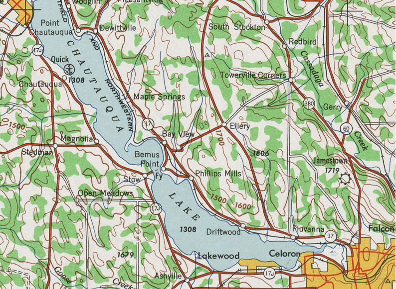
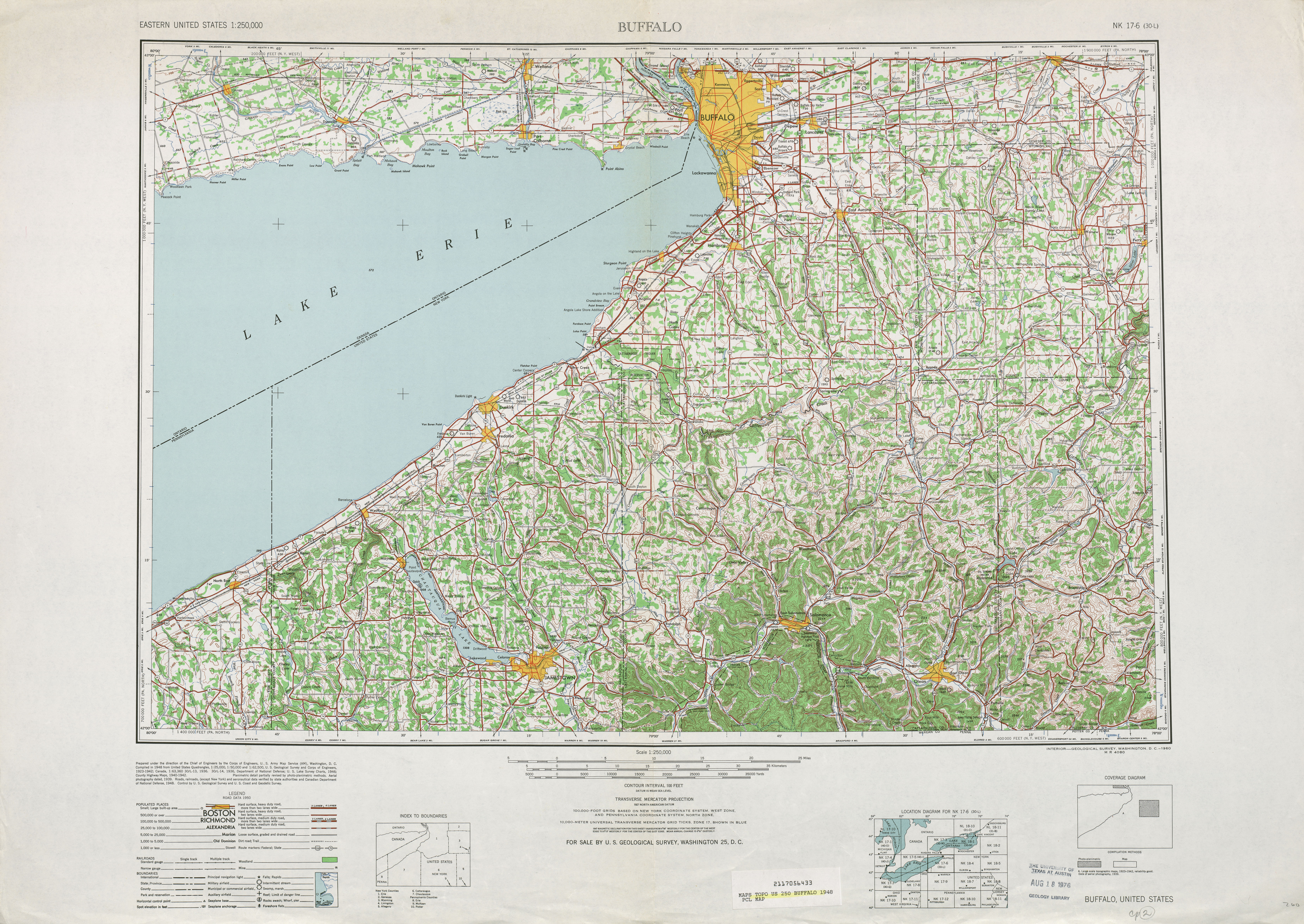
| Description |
1948 topographic quadrangle of former New York State Route 17J |
|---|---|
| Source |
Library at the university of Texas using United States Geological Survey topographic maps |
| Date |
2008-03-24 |
| Author |
United states geological survey (edited by Mitchazenia) |
| Permission (Reusing this image) |
see below |
[edit] Licensing
| This image is in the public domain because it contains materials that originally came from the United States Geological Survey, an agency of the United States Department of Interior. For more information, see the official USGS copyright policy |
|
File history
Click on a date/time to view the file as it appeared at that time.
| Date/Time | Dimensions | User | Comment | |
|---|---|---|---|---|
| current | 21:49, 24 March 2008 | 794×581 (1.1 MB) | Mitchazenia | ({{Information |Description=1948 topographic quadrangle of former New York State Route 17J |Source=[http://www.lib.utexas.edu/maps/topo/250k/txu-pclmaps-topo-us-buffalo-1948.jpg Library at the university of Texas using United States Geological Survey topog) |
File links
The following pages on the English Wikipedia link to this file (pages on other projects are not listed):

