Image:North carolina topographic.jpg
From Wikipedia, the free encyclopedia
Size of this preview: 800 × 301 pixels
Full resolution (1,086 × 409 pixels, file size: 110 KB, MIME type: image/jpeg)
| | This is a file from the Wikimedia Commons. The description on its description page there is shown below.
|
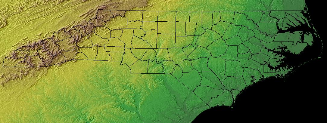
North Carolina - topographic map
Source:
| This work is in the public domain in the United States because it is a work of the United States Federal Government under the terms of Title 17, Chapter 1, Section 105 of the US Code. See Copyright.
Note: This only applies to works of the Federal Government and not to the work of any individual U.S. state, territory, commonwealth, county, municipality, or any other subdivision. العربية | Български | Česky | Deutsch | English | Español | Français | Magyar | Italiano | 日本語 | 한국어 | Polski | Português | 中文(繁體) | 中文(简体) | +/- |
 |
The text below is generated by a template which has been proposed for deletion. Please see its entry on Commons:Deletion requests/Template:Keywords for comments and reasoning.
| Keywords | · Español: norte carolina topografia verde amarillo |
File history
Click on a date/time to view the file as it appeared at that time.
| Date/Time | Dimensions | User | Comment | |
|---|---|---|---|---|
| current | 20:46, 10 November 2004 | 1,086×409 (110 KB) | Balcer | (North Carolina - topographic map) |
File links
The following pages on the English Wikipedia link to this file (pages on other projects are not listed):

