Image:NOAA chart 25664 1976 detail.png
From Wikipedia, the free encyclopedia
Size of this preview: 716 × 600 pixels
Full resolution (906 × 759 pixels, file size: 1.19 MB, MIME type: image/png)
| | This is a file from the Wikimedia Commons. The description on its description page there is shown below.
|
[edit] Summary
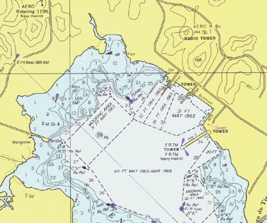
Detail of United States National Oceanic and Atmospheric Administration (NOAA) chart 25664 - Pasaje de Vieques and Radas Roosevelt, Puerto Rico.
This is from an outdated 1976 version of this chart; scanned by NOAA and provided through NOAA's Office of Coast Survey Historical Map and Chart Collection. Converted and clipped by the uploader.
[edit] Licensing
| This work is in the public domain in the United States because it is a work of the United States Federal Government under the terms of Title 17, Chapter 1, Section 105 of the US Code. See Copyright.
Note: This only applies to works of the Federal Government and not to the work of any individual U.S. state, territory, commonwealth, county, municipality, or any other subdivision. العربية | Български | Česky | Deutsch | English | Español | Français | Magyar | Italiano | 日本語 | 한국어 | Polski | Português | 中文(繁體) | 中文(简体) | +/- |
 |
File history
Click on a date/time to view the file as it appeared at that time.
| Date/Time | Dimensions | User | Comment | |
|---|---|---|---|---|
| current | 23:27, 1 January 2006 | 906×759 (1.19 MB) | Cdc | (Detail of United States National Oceanic and Atmospheric Administration (NOAA) chart 25664 - Pasaje de Vieques and Radas Roosevelt, Puerto Rico. This is from an outdated 1976 version of this chart; scanned by NOAA and provided through NOAA's Office of C) |
File links
The following pages on the English Wikipedia link to this file (pages on other projects are not listed):

