Image:Nilgiri Hills Topo.jpg
From Wikipedia, the free encyclopedia
Size of this preview: 474 × 599 pixels
Full resolution (1,504 × 1,900 pixels, file size: 3.99 MB, MIME type: image/jpeg)
| | This is a file from the Wikimedia Commons. The description on its description page there is shown below.
|
[edit] Summary
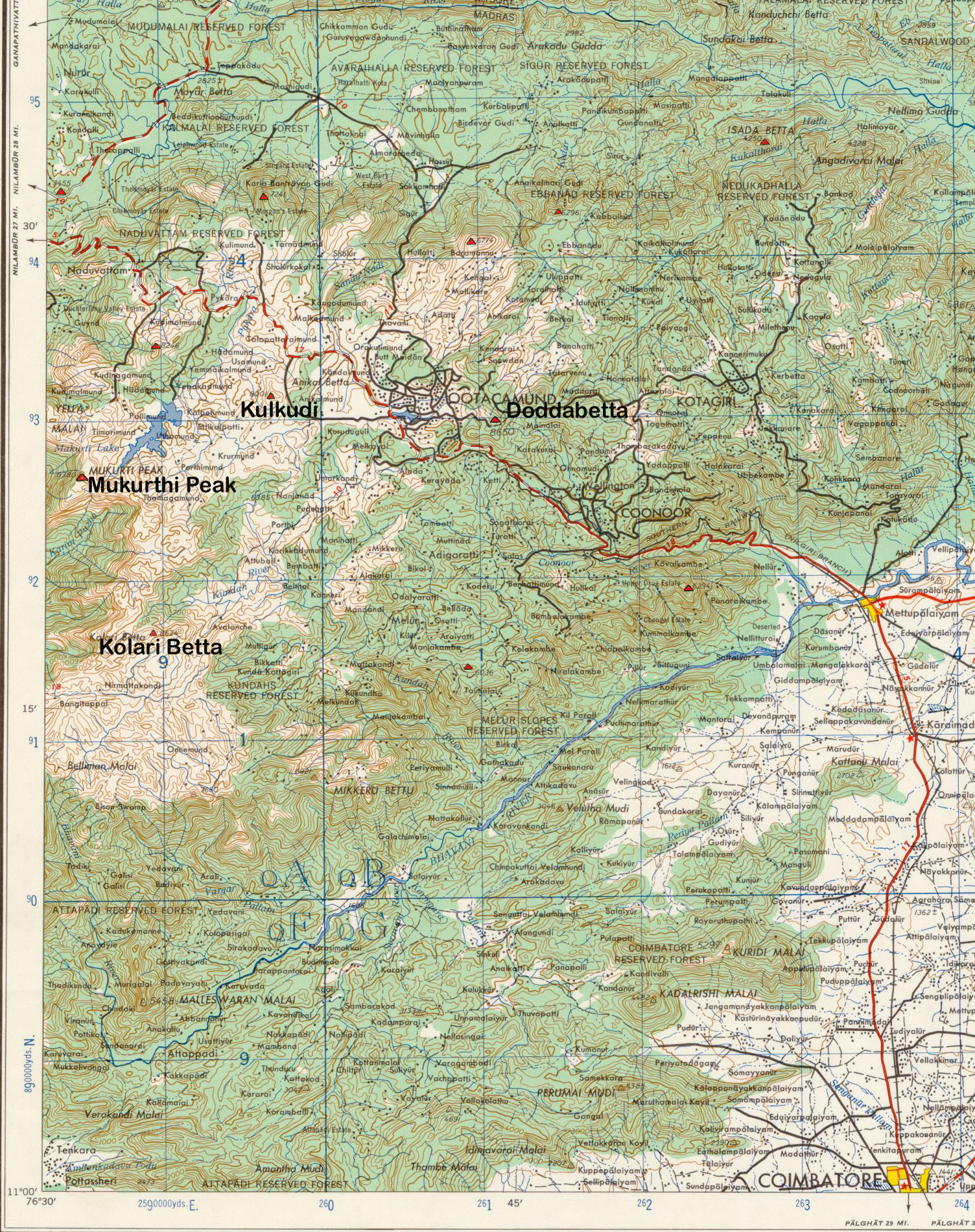
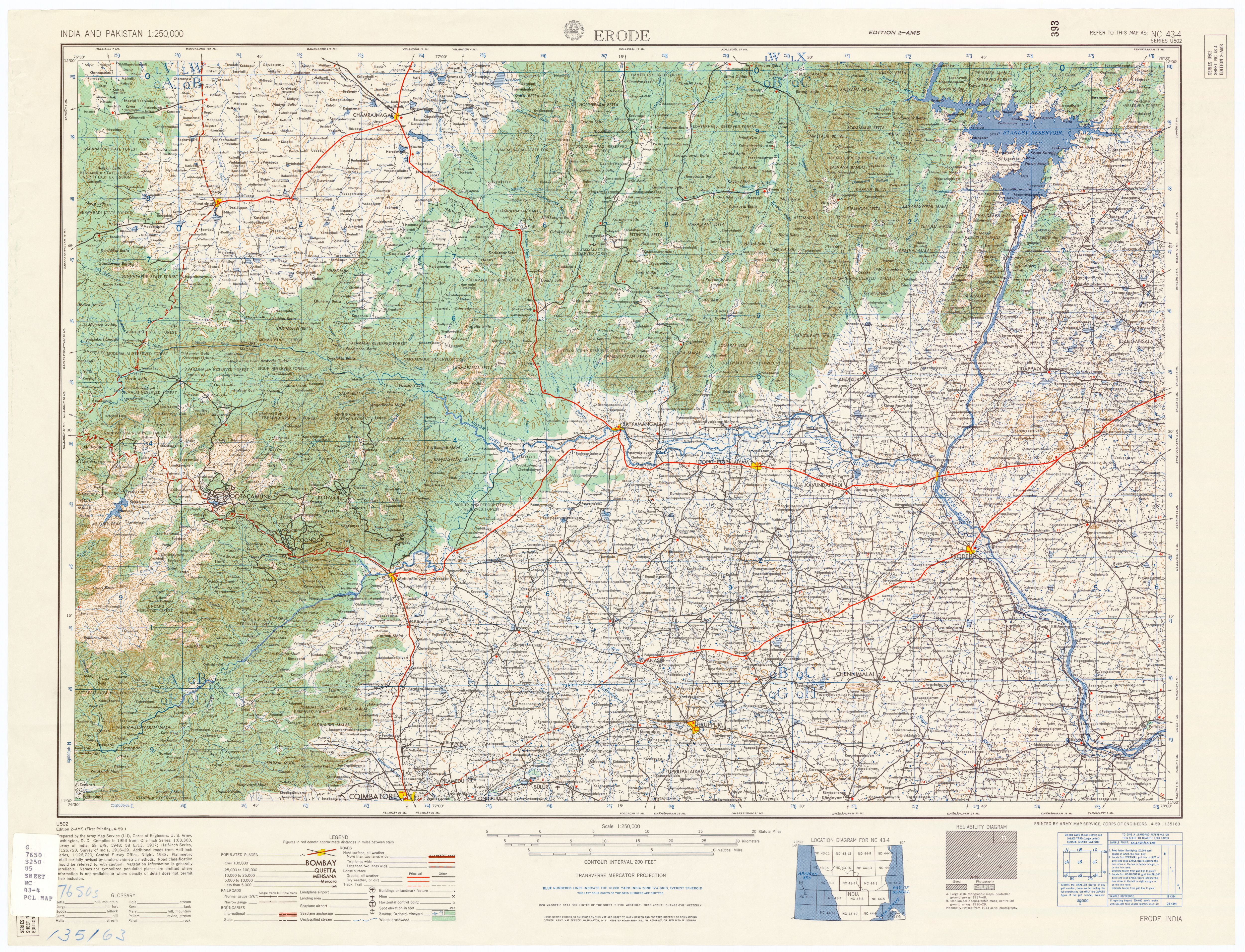
Description: Topo Map, Nilgiri Hills, Tamil Nadu, India.
Source: U.S. Army Topology Command, Erode India, sheet NC 43-4
Date: 1953
Author: U.S. Army Map Service, cropped by Marcus 9/3/2007
Permission: Public Domain
Other versions: Erode India, sheet NC 43-4
[edit] Licensing
| This image is a work of a U.S. Army soldier or employee, taken or made during the course of the person's official duties. As a work of the U.S. federal government, the image is in the public domain. |
 |
File history
Click on a date/time to view the file as it appeared at that time.
| Date/Time | Dimensions | User | Comment | |
|---|---|---|---|---|
| current | 04:02, 4 September 2007 | 1,504×1,900 (3.99 MB) | Marcus334 | (Description: Topo Map, Nilgiri Hills, Tamil Nadu, India. Source: U.S. Army Topology Command, Erode India, sheet NC 43-4 Date: 1953 Author: U.S. Army Map Service, cropped by Marcus 9/3/2007 Permission: Public Domain Other versions: [www.utexas.ed) |
File links
The following pages on the English Wikipedia link to this file (pages on other projects are not listed):
Metadata
This file contains additional information, probably added from the digital camera or scanner used to create or digitize it. If the file has been modified from its original state, some details may not fully reflect the modified file.
| Orientation | Normal |
|---|---|
| Horizontal resolution | 400 dpi |
| Vertical resolution | 400 dpi |
| Software used | Adobe Photoshop 7.0 |
| File change date and time | 23:55, 3 September 2007 |
| Color space | 65535 |

