New York State Route 383
From Wikipedia, the free encyclopedia
 |
|||||||||||||
| NY Route 383 |
|||||||||||||
| Length: | 18.70 mi[1] (30.09 km) | ||||||||||||
|---|---|---|---|---|---|---|---|---|---|---|---|---|---|
| Formed: | By 1947[2] | ||||||||||||
| South end: | |||||||||||||
| Major junctions: |
|||||||||||||
| North end: | |||||||||||||
| Counties: | Monroe | ||||||||||||
|
|||||||||||||
New York State Route 383 is an 18.70-mile (30.09 km) long north-south state highway in Monroe County, New York, United States. The southern terminus of the route is at NY 36 in Mumford. The northern terminus is at NY 31 in downtown Rochester. The route follows the Genesee River and its tributaries for its entire length.
Contents |
[edit] Route description
| Communities |
|---|
The route, located entirely within the confines of Monroe County, follows the water bodies of Oatka Creek and the Genesee River.
NY 383 begins at an intersection with route 36 in the small town of Mumford, located just of the border between Monroe and Livingston County. Taking on the name Scottsville-Mumford Road, route 383 follows Oatka Creek north, passing through Wheatland and entering Scottsville, where it becomes Caledonia Avenue. After intersecting with NY 386 at its southern terminus, NY 383 turns east onto Main Street then returns north at NY 251's western terminus, becoming Rochester Street. North of the intersection with route 251, NY 383 intersects the western terminus of NY 253 and becomes Scottsville Road.
Between Scottsville and Chili, NY 383 begins to parallel the path of the Genesee River, as it does for the remainder of its length, and passes over the New York State Thruway. In Chili, route 383 crosses over NY 252 and intersects NY 252A at its eastern terminus before interchanging with I-390 at exit 17 and entering Rochester.
Shortly after entering the City of Rochester, NY 383 continues north along Genesee Street between Elmwood Avenue and Brooks Avenue, then along Brooks to South Plymouth Avenue. However, as of September 2006, there are no signs along the segment.
North of Brooks, NY 383 continues north on South Plymouth Avenue, then crosses east over to Exchange Boulevard via Ford Street. On Exchange Blvd., Route 383 passes under I-490 (which passes over both NY 383 and the Genesee River via the Troup-Howell Bridge) before reaching its northern terminus at East Broad Street (NY 31).
[edit] History
The portion of modern NY 383 from Mumford to Scottsville was initially designated as part as NY 253 in the 1930 renumbering.[3] By 1938, it, along with the remainder of what is now NY 383, was designated as New York State Route 35. NY 35 continued past the current northern terminus of NY 383, following Main Street, Winton Road, and Blossom Road east through Rochester. NY 35 remained on Blossom to Atlantic Avenue (modern NY 286), where it then followed what is now NY 286 to Walworth. The route continued north on the current routing of NY 350 to Ontario Center, where it ended at U.S. Route 104 (Ridge Road).[4] The entirety of NY 35, except for the portion that is now NY 350 in Wayne County, was redesignated as NY 383 by 1947.[2] NY 383 was then truncated to its current northern terminus in downtown Rochester by 1961.[5]
NY 47 was concurrent to NY 383 for a short distance along Elmwood Avenue between Scottsville Road and South Plymouth Avenue, and later along Scottsville Road from Interstate 390 to Elmwood Avenue as well, until 1980, when the NY 47 designation was removed.[6][7]
In the mid-2000s, NY 383 was rerouted between Elmwood and Brooks Avenues. Originally, NY 383 turned east on Elmwood Avenue before resuming its northward progression on South Plymouth Avenue, rejoining its current alignment at Brooks Avenue.[8] Due to the Brooks Landing riverside development project, which included the removal of South Plymouth immediately south of Brooks Avenue, NY 383 was rerouted to continue north at Elmwood Avenue onto Genesee Street before turning east on Brooks Avenue to connect to South Plymouth.[1]
[edit] Major intersections
| County | Location | Mile[1] | Roads intersected | Notes |
|---|---|---|---|---|
| Monroe | Mumford | 0.00 | ||
| Scottsville | 5.73 | Southern terminus of NY 386 | ||
| 6.21 | Western terminus of NY 251 | |||
| 6.88 | Western terminus of NY 253 | |||
| Chili | 12.65 | |||
| 13.84 | Eastern terminus of NY 252A | |||
| Rochester | 15.50 | Exit 17 (I-390) | ||
| 18.70 |
[edit] References
- ^ a b c Traffic Data Report - NY 305 to NY 427 (PDF). NYSDOT (2007-07-16). Retrieved on 2007-08-14.
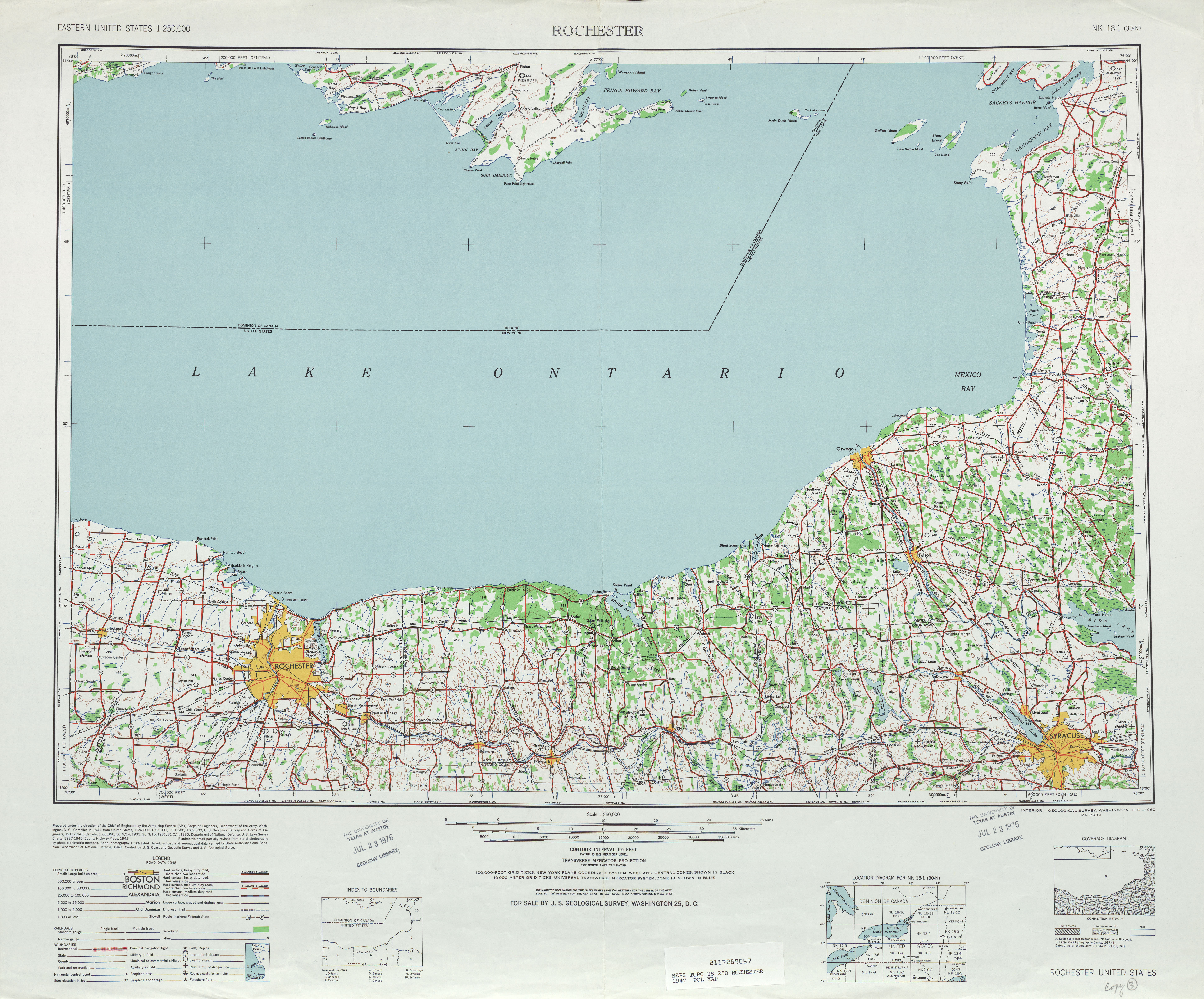
- ^ a b United States Geological Survey. Rochester, NY Quadrangle [map], 1:250,000, Eastern United States 1:250,000. (1947) Retrieved on 2007-11-20.
- ^ Leon A. Dickinson. "New Signs for State Highways", New York Times, 1930-01-12, p. 136.
- ^ Automobile Legal Association (ALA) Automobile Green Book, 1938/39 edition, (W.A. Thibodeau, 1938).
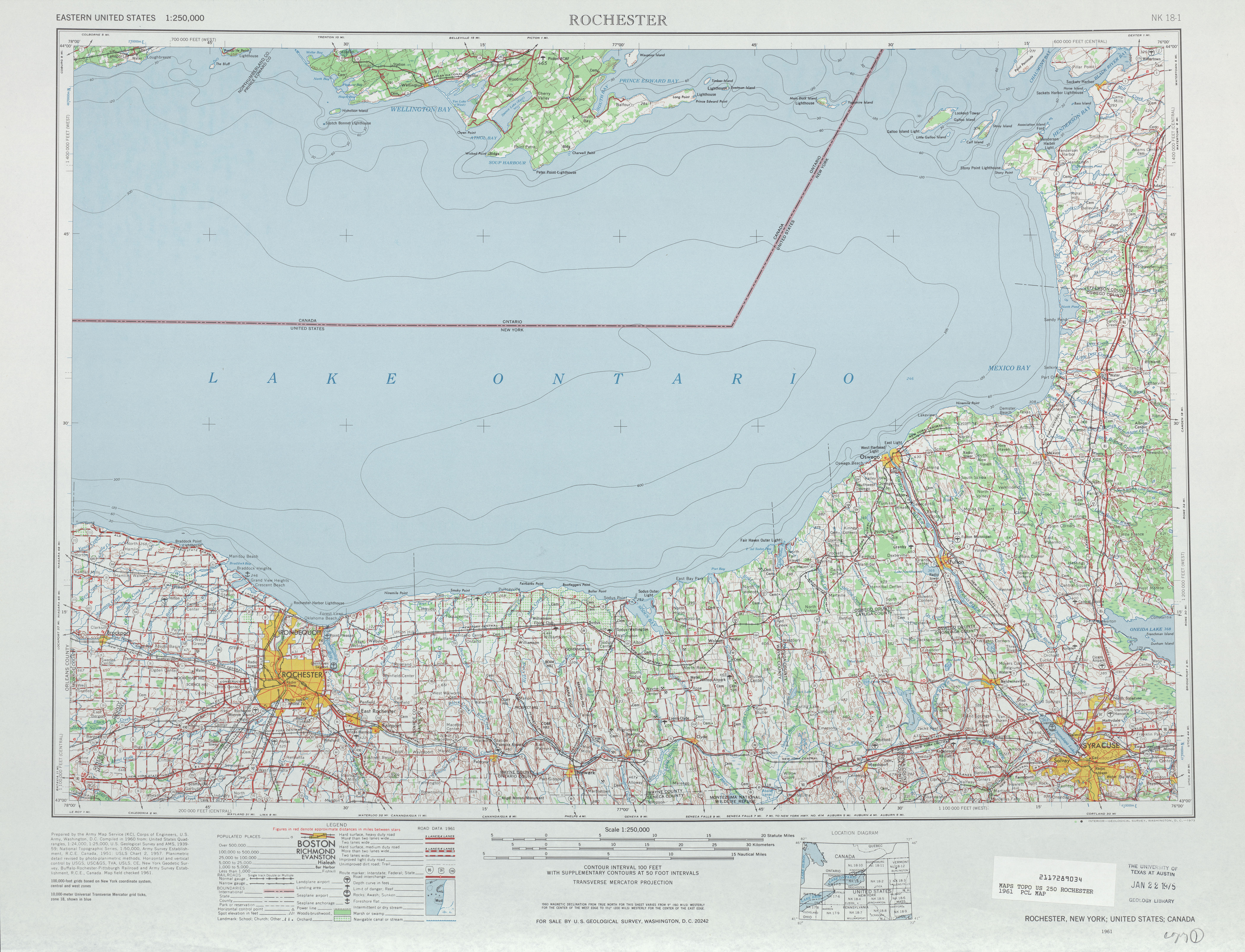
- ^ United States Geological Survey. Rochester, NY Quadrangle [map], 1:250,000, Eastern United States 1:250,000. (1961) Retrieved on 2007-11-20.
- ^ Humble Oil & Refining Company. New York [map]. Cartography by General Drafting. (1971)
- ^ Official Description of Highway Touring Routes, Scenic Byways, & Bicycle Routes in New York State. NYSDOT. Retrieved on 2007-08-14.
- ^ Traffic Volume Report for Monroe County. NYSDOT (2003). Retrieved on 2007-08-14.

