Image:New Brunswick road map.png
From Wikipedia, the free encyclopedia
No higher resolution available.
New_Brunswick_road_map.png (560 × 448 pixels, file size: 31 KB, MIME type: image/png)
| | This is a file from the Wikimedia Commons. The description on its description page there is shown below.
|
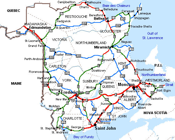
New Brunswick road map showing counties and towns
This map has been created by the uploader, en:User:Kirjtc2. It is licensed under GFDL.

File history
Click on a date/time to view the file as it appeared at that time.
| Date/Time | Dimensions | User | Comment | |
|---|---|---|---|---|
| current | 08:28, 1 June 2005 | 560×448 (31 KB) | Frieda | (New Brunswick road map showing counties and towns This map has been created by the uploader, en:User:Kirjtc2. It is licensed under GFDL. {{GFDL}} ) |
File links
The following pages on the English Wikipedia link to this file (pages on other projects are not listed):

