Image:NewSwabiaMap.jpg
From Wikipedia, the free encyclopedia
Size of this preview: 600 × 600 pixels
Full resolution (714 × 714 pixels, file size: 68 KB, MIME type: image/jpeg)
| | This is a file from the Wikimedia Commons. The description on its description page there is shown below.
|
[edit] Licensing
|
File history
Click on a date/time to view the file as it appeared at that time.
| Date/Time | Dimensions | User | Comment | |
|---|---|---|---|---|
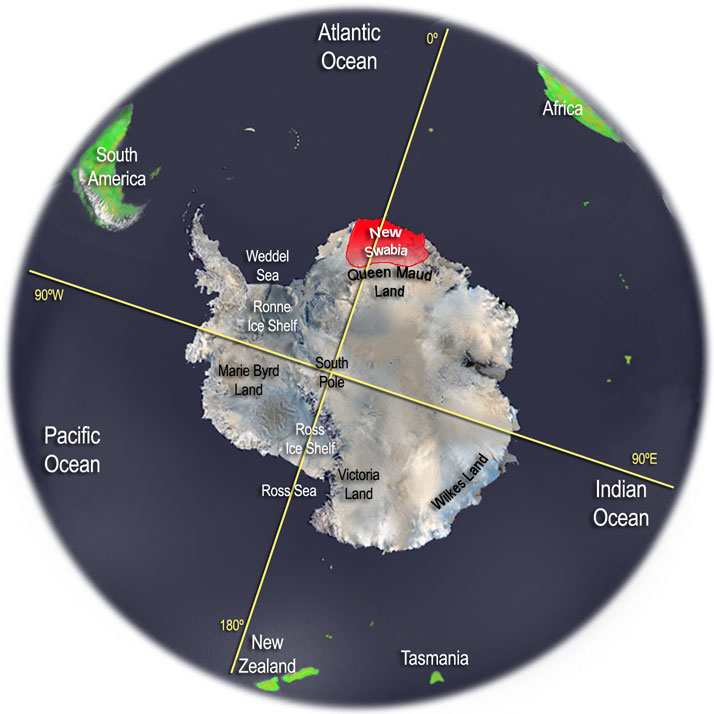
| current | 04:00, 29 January 2006 | 714×714 (68 KB) | Thomas Blomberg | (Antarctica map with the Nazi Germany claim area New Swabia highlighted. The map is done by me, Thomas Blomberg, in Photoshop, using a variety of sources, including a satellite image (i.e. NASA) of Antarctica.~~~~) |
File links
The following pages on the English Wikipedia link to this file (pages on other projects are not listed):

