Image:NewHavenAreaOutlineMap.png
From Wikipedia, the free encyclopedia
Size of this preview: 507 × 600 pixels
Full resolution (515 × 609 pixels, file size: 9 KB, MIME type: image/png)
| | This is a file from the Wikimedia Commons. The description on its description page there is shown below.
|
| Description |
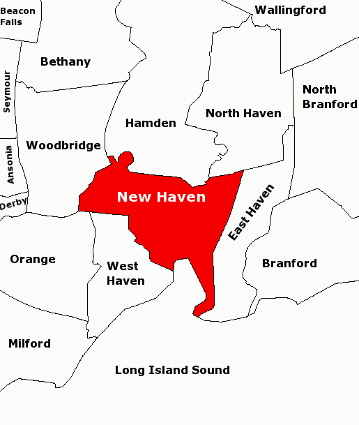
Subject: Map of townships in the New Haven Area. 21-Aug-2007 version fixes town name in upper left: Beacon Falls. Derived from sub-county SVG map of Connecticut at Libre Map Project using Adobe SVG viewer and Gimp 2.2.1.3 |
|---|---|
| Source |
Originally from en.wikipedia; description page is/was here. |
| Date |
2007-08-04 (first version); 2007-08-21 (last version) |
| Author |
Original uploader was Karlhahn at en.wikipedia |
| Permission (Reusing this image) |
CC-BY-2.0. |
[edit] License information
| This file is licensed under Creative Commons Attribution 2.0 License |
[edit] Original upload log
(All user names refer to en.wikipedia)
- 2007-08-21 12:31 Karlhahn 515×609×4 (9674 bytes) Subject: Map of townships in the New Haven Area. 21-Aug-2007 version fixes town name in upper left to Beacon Falls. Derived from sub-county SVG map of Connecticut at [http://libremap.org/data/boundary/ Libre Map Project] using Adobe SVG viewer and Gimp
- 2007-08-04 13:18 Karlhahn 515×609×8 (15969 bytes) Subject: Map of townships in the New Haven Area Derived from sub-county SVG map of Connecticut at [http://libremap.org/data/boundary/ Libre Map Project] using Adobe SVG viewer and Gimp 2.2.1.3 {{cc-by-sa}}
- 2007-08-04 02:47 Karlhahn 515×609×8 (14096 bytes) Subject: Map of townships in the New Haven Area Derived from sub-county SVG map of Connecticut at [http://libremap.org/data/boundary/ Libre Map Project] using Adobe SVG viewer and Gimp 2.2.1.3 {{cc-by-sa}}
- 2007-08-04 02:38 Karlhahn 515×609×8 (13471 bytes) Subject: Map of townships in the New Haven Area Derived from sub-county SVG map of Connecticut at [http://libremap.org/data/boundary/ Libre Map Project] using Adobe SVG viewer and Gimp 2.2.1.3 {{cc-by-sa}}
File history
Click on a date/time to view the file as it appeared at that time.
| Date/Time | Dimensions | User | Comment | |
|---|---|---|---|---|
| current | 17:18, 24 August 2007 | 515×609 (9 KB) | Karlhahn | ({{Information |Description=Subject: Map of townships in the New Haven Area. 21-Aug-2007 version fixes town name in upper left: Beacon Falls. Derived from sub-county SVG map of Connecticut at [http://libremap.org/data/boundary/ Libre Map Project] using Ad) |
File links
The following pages on the English Wikipedia link to this file (pages on other projects are not listed):

