Image:Netherlands Antilles-CIA WFB Map.png
From Wikipedia, the free encyclopedia
No higher resolution available.
Netherlands_Antilles-CIA_WFB_Map.png (329 × 353 pixels, file size: 10 KB, MIME type: image/png)
| | This is a file from the Wikimedia Commons. The description on its description page there is shown below.
|
[edit] Summary
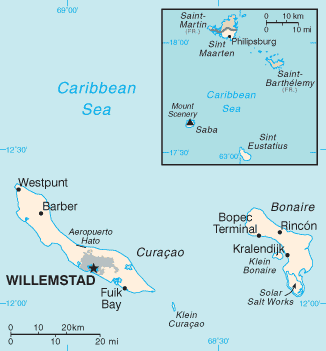
Español: Mapa Antillas Neerlandesas
| This image is in the public domain because it contains materials that originally came from the United States Central Intelligence Agency's World Factbook.
Deutsch | English | Español | Français | 日本語 | Nederlands | 한국어 | Português | தமிழ் | Magyar | +/- |
 |
File history
Click on a date/time to view the file as it appeared at that time.
| Date/Time | Dimensions | User | Comment | |
|---|---|---|---|---|
| current | 09:05, 30 January 2006 | 329×353 (10 KB) | Hoshie | (Updated map of the Netherlands Antilles from the CIA Factbook, 10 Jan 06 rev: http://www.cia.gov/cia/publications/factbook/maps/nt-map.gif) |
| 09:16, 27 March 2005 | 329×354 (6 KB) | Wolfman | ({{CIA-map}}) |
File links
The following pages on the English Wikipedia link to this file (pages on other projects are not listed):

