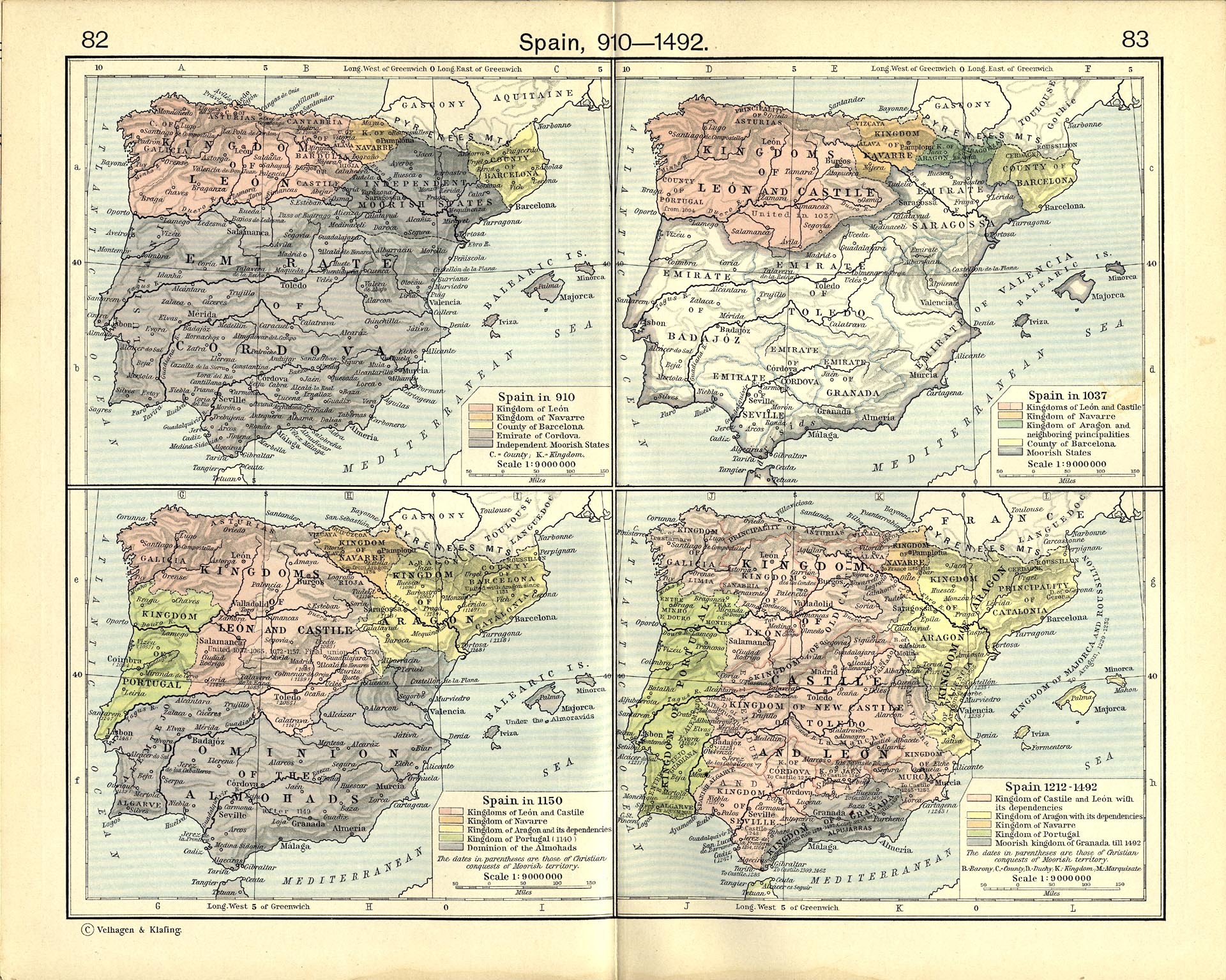
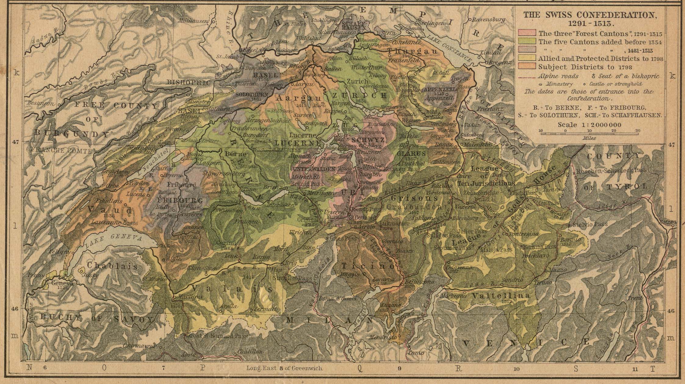
User:Necrothesp/Resources/1200s Resources
From Wikipedia, the free encyclopedia
Contents |
[edit] International
- Maps
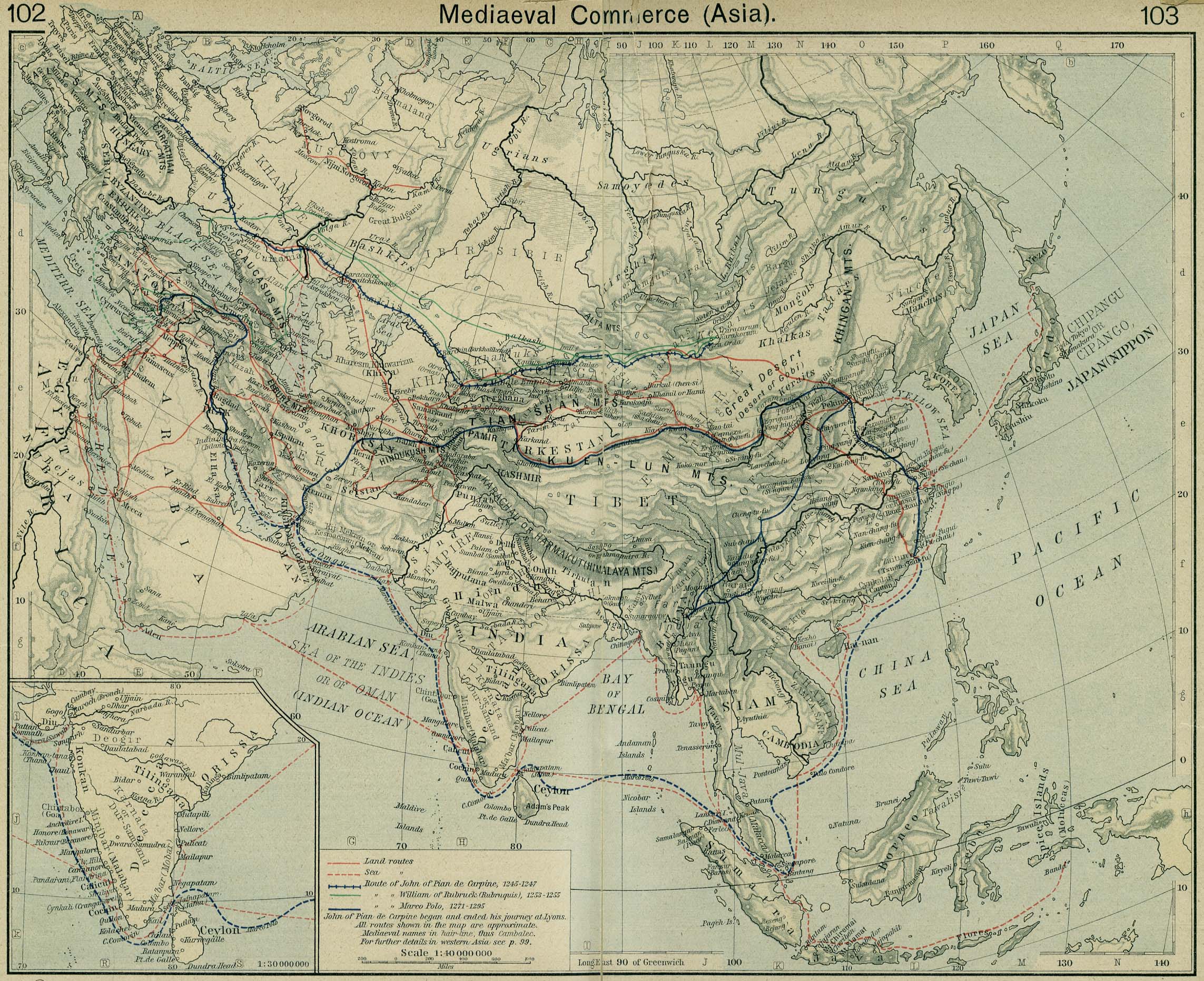
- Map of commerce routes in Asia
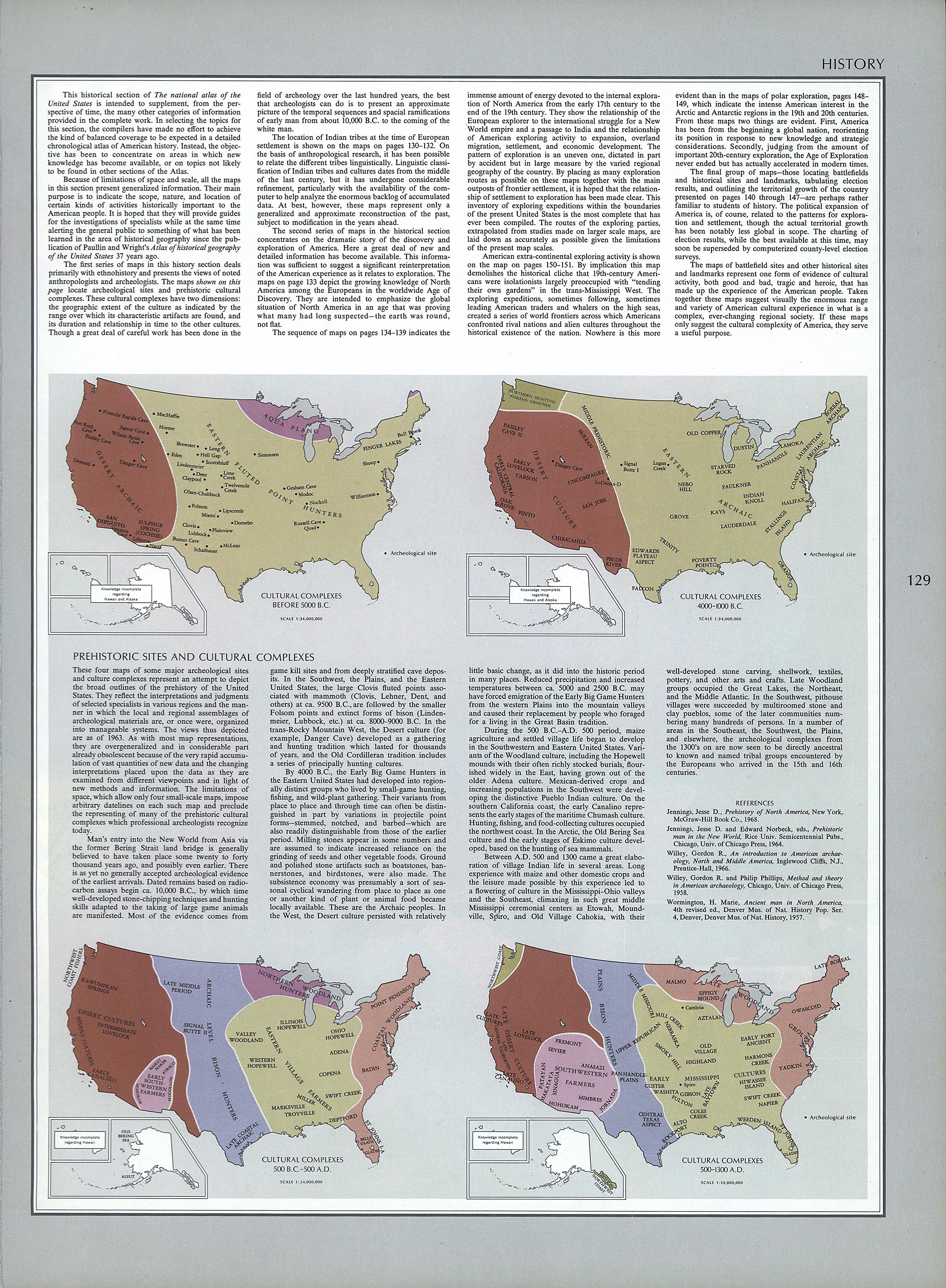
- Cultural maps of North America to 1300
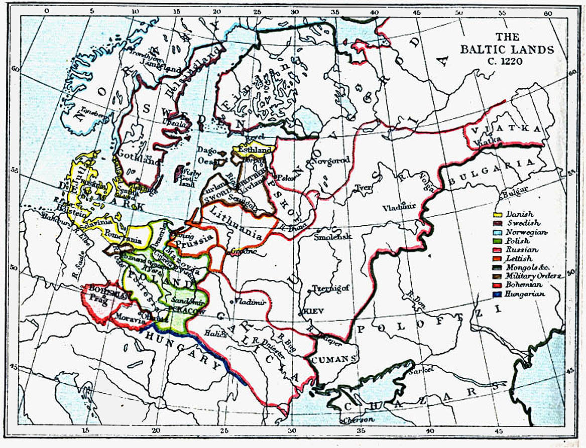
- Map of the lands surrounding the Baltic, 1220
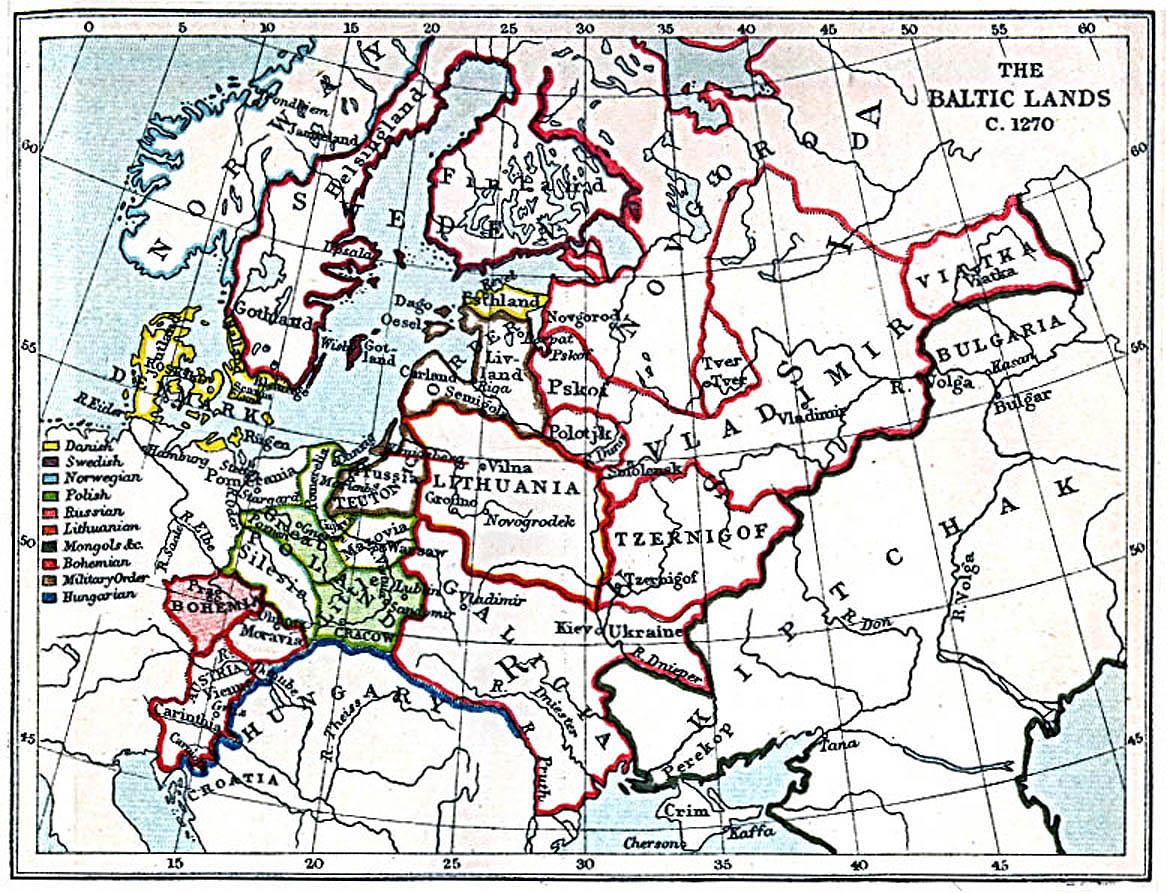
- Map of the lands surrounding the Baltic, 1270
- Map of the spread of Christianity, 590–1300
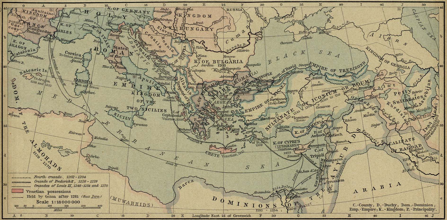
- Map of the Mediterranean, 1204–1270
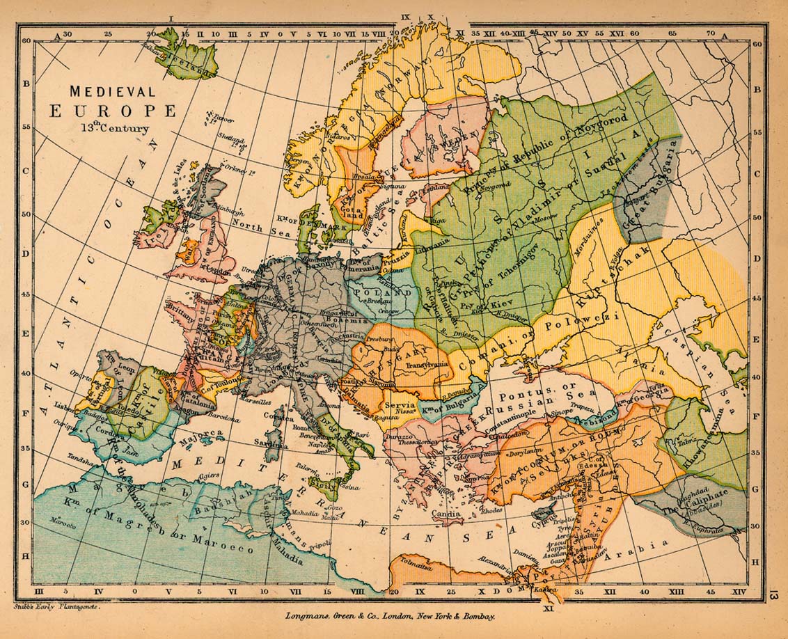
- Map of Europe in the 13th century
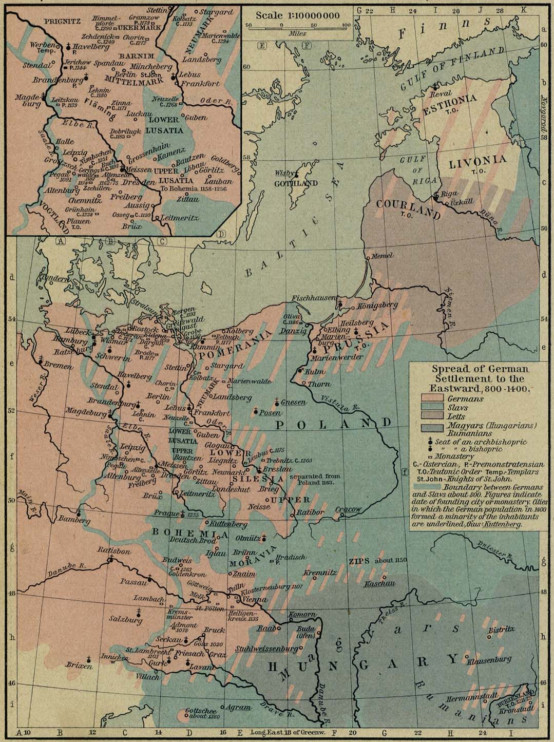
- Map of the spread of Germanic settlement, 800–1400
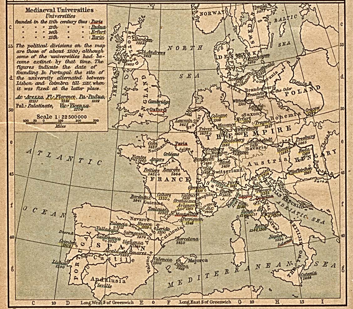
- Map of universities in Europe
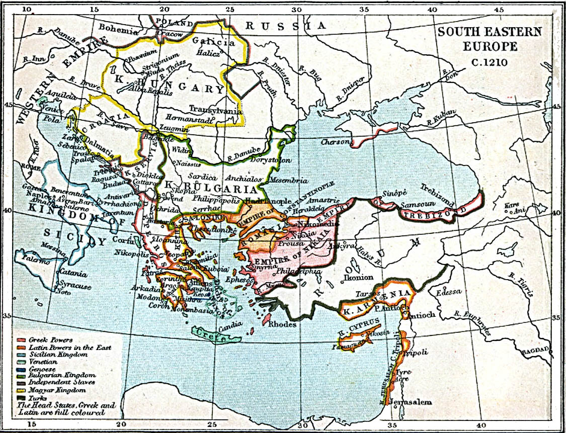
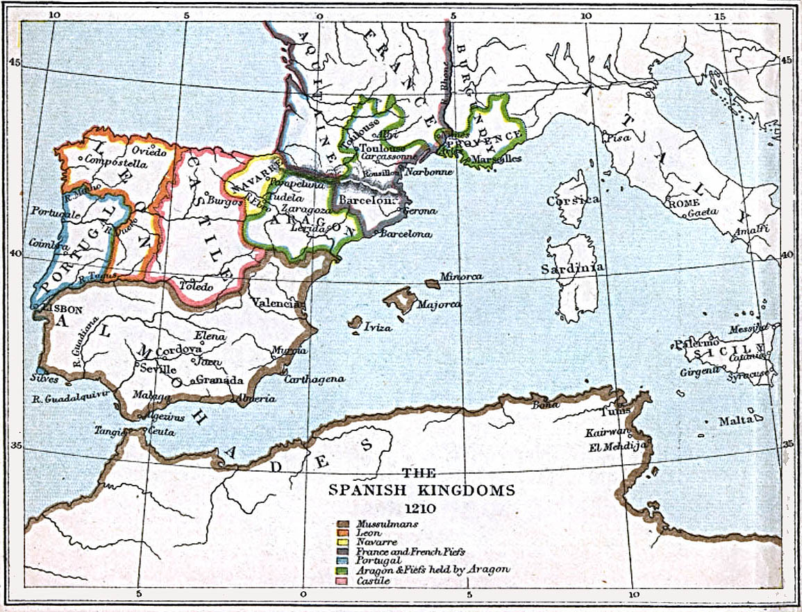
- Map of South-Eastern Europe and the Middle East, 1210
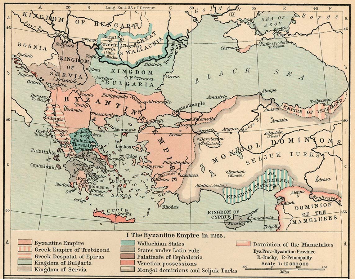
[edit] Byzantine Empire
[edit] England
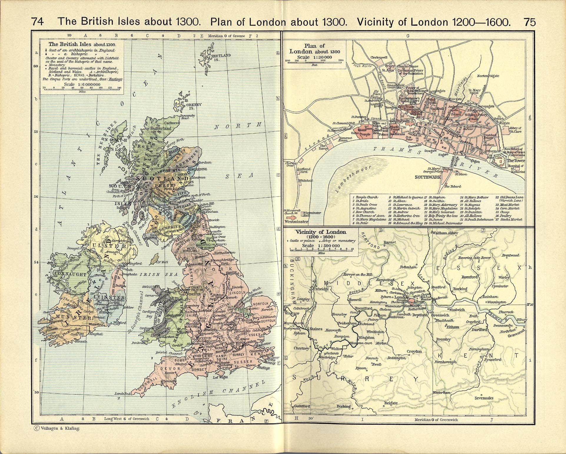
- Maps
- London
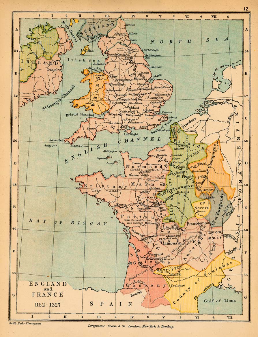
[edit] France
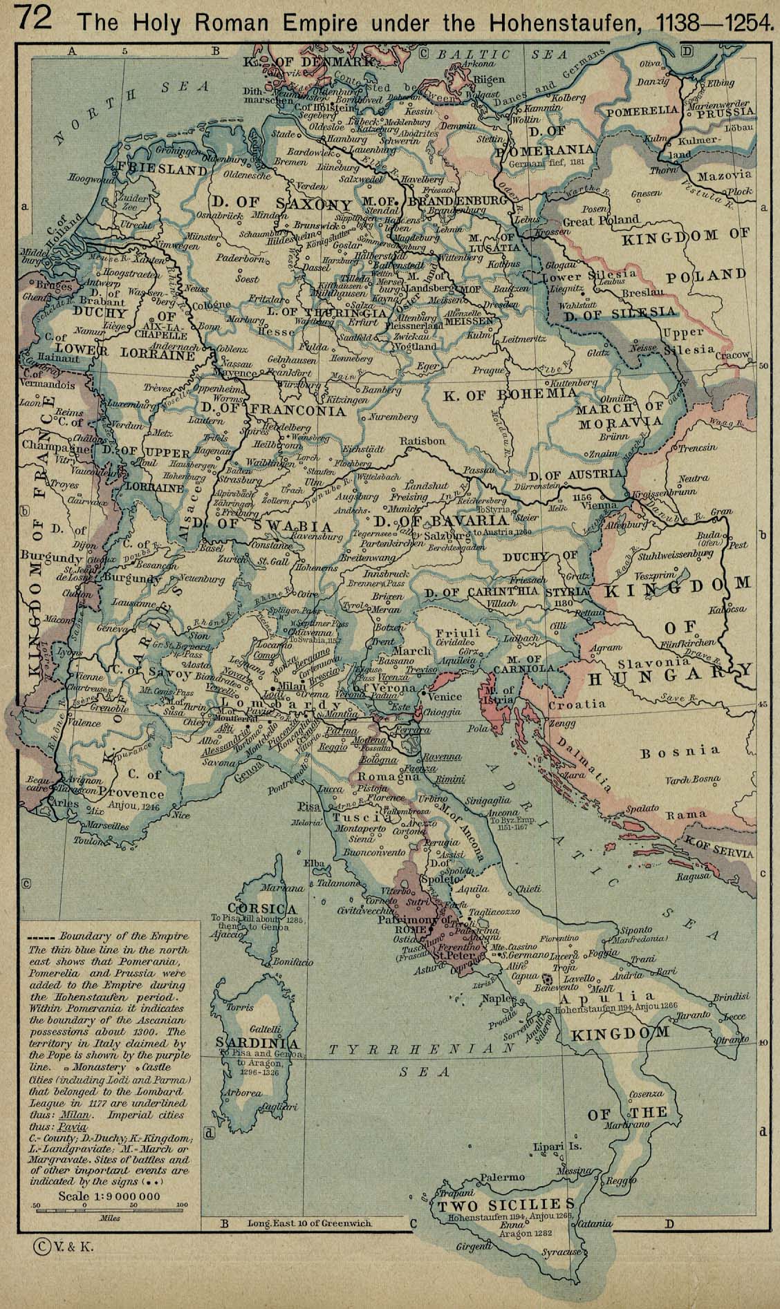
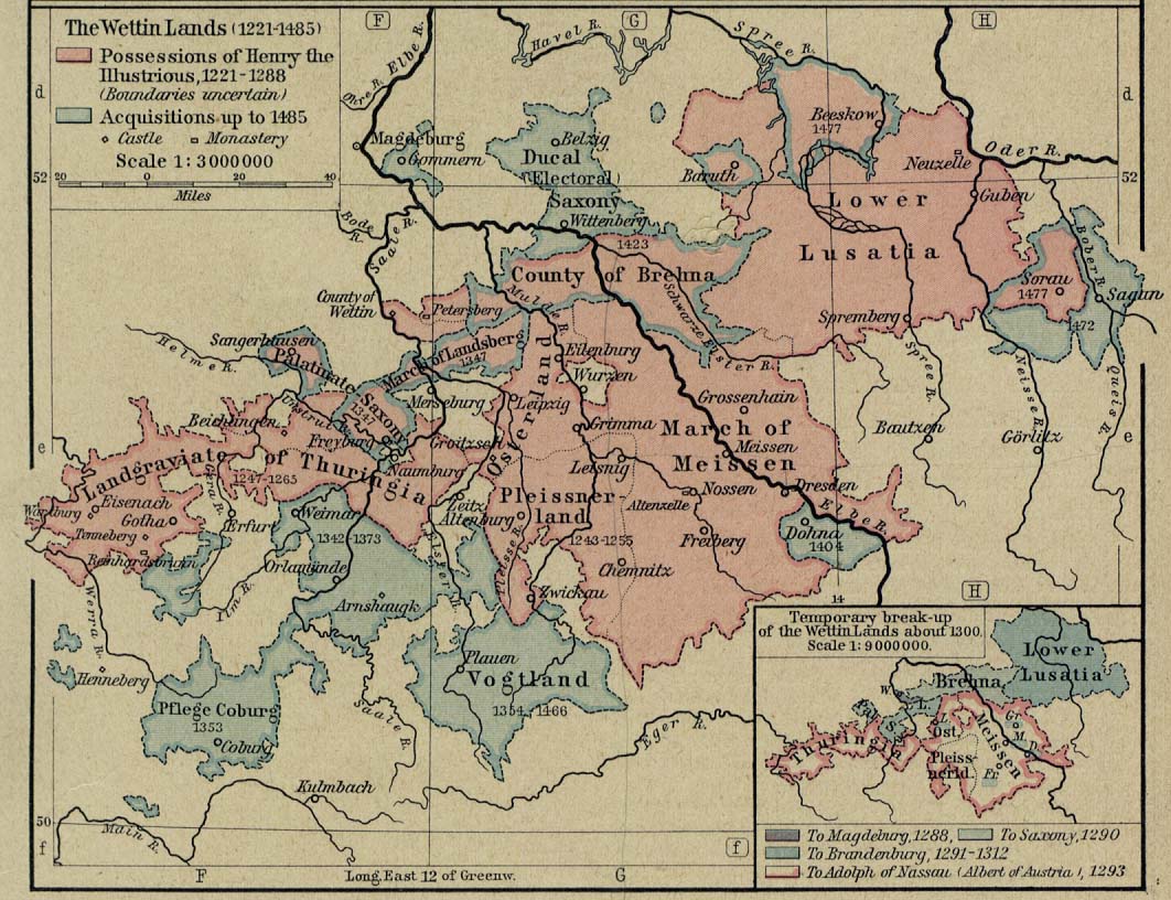
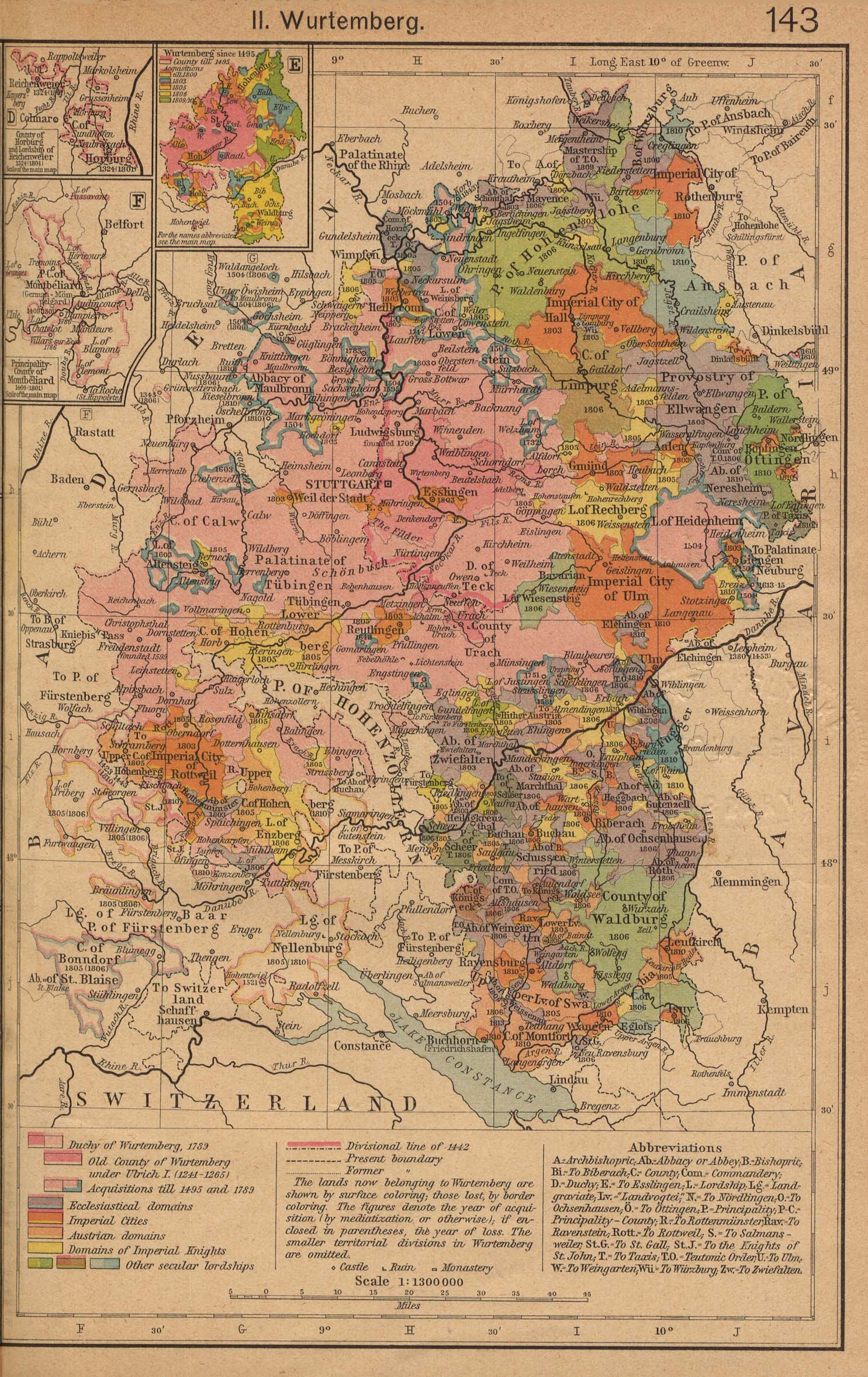
[edit] Holy Roman Empire
- Maps

