Image:Navy Island map.png
From Wikipedia, the free encyclopedia
No higher resolution available.
Navy_Island_map.png (478 × 600 pixels, file size: 174 KB, MIME type: image/png)
| | This is a file from the Wikimedia Commons. The description on its description page there is shown below.
|
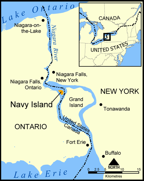
A map showing the location of Navy Island in the Niagara River. The nearby Grand Island is also shown, as are the towns of Niagara Falls, Niagara-on-the-Lake, Tonawanda, Buffalo, and Fort Erie.
Created by NormanEinstein, May 11, 2005.

File history
Click on a date/time to view the file as it appeared at that time.
| Date/Time | Dimensions | User | Comment | |
|---|---|---|---|---|
| current | 14:32, 19 May 2005 | 478×600 (174 KB) | NormanEinstein | |
| 20:05, 11 May 2005 | 683×740 (116 KB) | NormanEinstein | (A map showing the location of Navy Island in the Niagara River. The nearby Grand Island is also shown, as are the towns of Niagara Falls, Niagara-on-the-Lake, Tonawanda, Buffalo, and Fort Erie. Created by NormanEinstein. {{PD-self}}) |
File links
The following pages on the English Wikipedia link to this file (pages on other projects are not listed):

