Image:Nagpur.png
From Wikipedia, the free encyclopedia
Size of this preview: 800 × 551 pixels
Full resolution (1,440 × 992 pixels, file size: 282 KB, MIME type: image/png)
| | This is a file from the Wikimedia Commons. The description on its description page there is shown below.
|
[edit] Summary
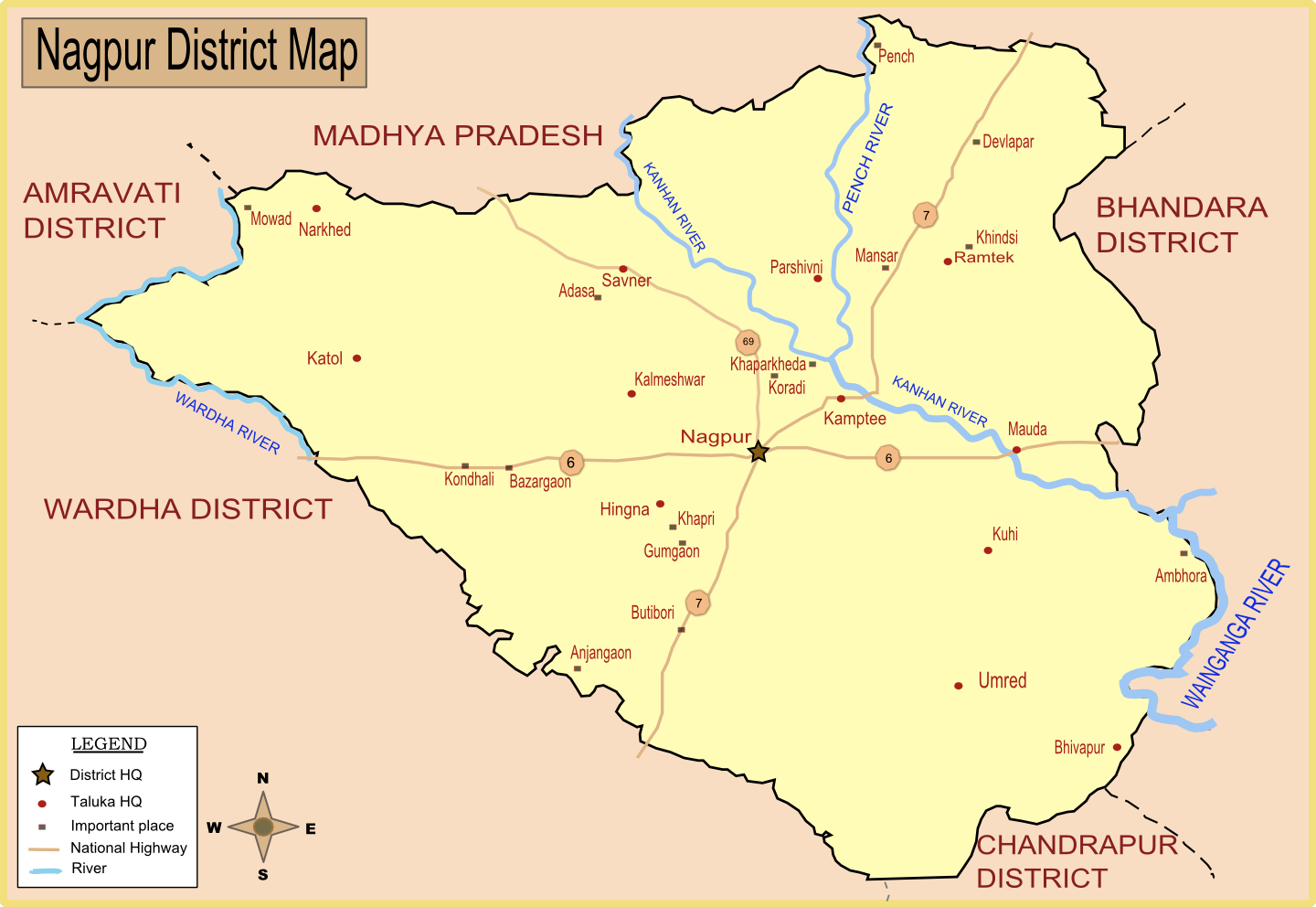
| Description |
Map of Nagpur district with major towns and rivers. I have created this map by taking reference from Nagpur district collector's website. |
|---|---|
| Source |
self-made |
| Date |
21-Jan-2008 |
| Author | |
| Permission (Reusing this image) |
Please site my name in case of reuse or any other use. |
[edit] Licensing

File history
Click on a date/time to view the file as it appeared at that time.
| Date/Time | Dimensions | User | Comment | |
|---|---|---|---|---|
| current | 09:33, 24 January 2008 | 1,440×992 (282 KB) | Wikigringo | (Added all Taluka headquarters along with major places. Added legend. need to add railway, airport now. Source of this map: Nagpur District collector's website.) |
| 08:27, 23 January 2008 | 1,053×725 (162 KB) | Wikigringo | (I have added Ramtek, and also added major national highways in the map.) | |
| 08:50, 21 January 2008 | 1,041×733 (95 KB) | Wikigringo | ({{Information |Description=Map of Nagpur district with major towns and rivers. I have created this map by taking reference from Nagpur district collector's website. |Source=self-made |Date=21-Jan-2008 |Author= Wikigringo |Permission=Pl) |
File links
The following pages on the English Wikipedia link to this file (pages on other projects are not listed):

