Image:Mt Harun from Taybe.JPG

From Wikipedia, the free encyclopedia

Wikimedia Commons logo This is a file from the Wikimedia Commons. The description on its description page there is shown below.
Commons is a freely licensed media file repository. You can help.

[edit] Summary

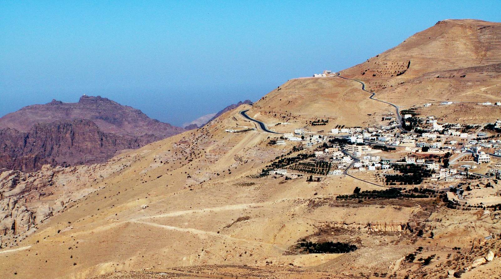
Jebel Harun (mt. of Aaron) at the left as seen from the Village of Taybe, south of Petra. the top of Jebel Harun has two peaks. on the right peak is the "Welly", The mosque on the grave of Aaron. in the photo it can be seen as a white dot on the top.

Jebel Harun is part of Petra archeological site.

Jebel Harun is located in the Horeb mountains, The red rocks area of Petra. high above the Horeb mountains is Mt. Seir or jebel A-Shara, where the village of Taybe is located and many other small villages. Photo by Uri Juda

[edit] Licensing

I, the copyright holder of this work, hereby publish it under the following licenses:
GNU head Permission is granted to copy, distribute and/or modify this document under the terms of the GNU Free Documentation license, Version 1.2 or any later version published by the Free Software Foundation; with no Invariant Sections, no Front-Cover Texts, and no Back-Cover Texts. A copy of the license is included in the section entitled "GNU Free Documentation license".

Aragonés | العربية | Asturianu | Български | বাংলা | ইমার ঠার/বিষ্ণুপ্রিয়া মণিপুরী | Brezhoneg | Bosanski | Català | Cebuano | Česky | Dansk | Deutsch | Ελληνικά | English | Esperanto | Español | Eesti | Euskara | فارسی | Suomi | Français | Gaeilge | Galego | עברית | Hrvatski | Magyar | Bahasa Indonesia | Ido | Íslenska | Italiano | 日本語 | ქართული | ភាសាខ្មែរ | 한국어 | Kurdî / كوردی | Latina | Lëtzebuergesch | Lietuvių | Bahasa Melayu | Nnapulitano | Nederlands | ‪Norsk (nynorsk)‬ | ‪Norsk (bokmål)‬ | Occitan | Polski | Português | Română | Русский | Slovenčina | Slovenščina | Shqip | Српски / Srpski | Svenska | తెలుగు | ไทย | Türkçe | Українська | اردو | Tiếng Việt | Volapük | Yorùbá | ‪中文(中国大陆)‬ | ‪中文(台灣)‬ | +/-

Some rights reserved
Creative Commons Attribution iconCreative Commons Share Alike icon
This file is licensed under the Creative Commons Attribution ShareAlike license versions 2.5, 2.0, and 1.0

العربية | Български | Català | Česky | Dansk | Deutsch | English | Español | Euskara | فارسی | Français | עברית | Italiano | 日本語 | 한국어 | Lietuvių | Nederlands | Polski | Português | Русский | Svenska | தமிழ் | Türkçe | 中文 | 中文 | +/-

You may select the license of your choice.

File history

Click on a date/time to view the file as it appeared at that time.

Date/TimeDimensionsUserComment
current23:18, 14 January 20061,600×891 (301 KB)Uri (Jebel Harun (mt. of Aaron) at the left as seen from the Vilage of Taybe, south of Petra. Mt. Harun is located in the Horeb mountains, The red rocks area of Petra. high above the Horeb mountains is Mt. Seir or jebel A-Shara where we can see the village of)
The following pages on the English Wikipedia link to this file (pages on other projects are not listed):