Image:MSTL Map.png
From Wikipedia, the free encyclopedia
Size of this preview: 667 × 600 pixels
Full resolution (1,038 × 933 pixels, file size: 275 KB, MIME type: image/png)
| | This is a file from the Wikimedia Commons. The description on its description page there is shown below.
|
| Description |
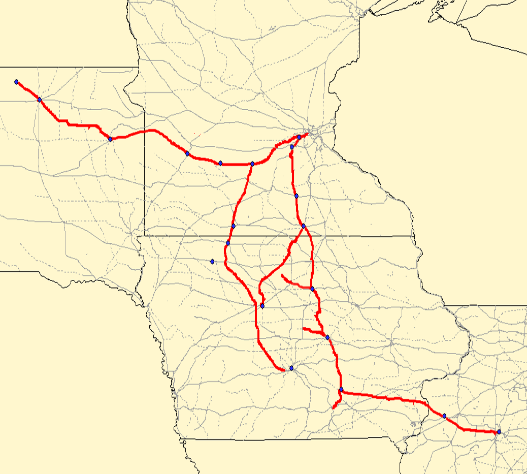
Map of the en:Minneapolis and St. Louis Railway. Red lines are the MSTL route; gray lines are other railroads. Created using Quantum GIS using data from the Bureau of Transportation Statistics under "Railway Network (1:100,000 base scale)" and queried against the previous railroad of "MSTL". Rechecked against Cash Groth's site and missing/dirty data filled in. |
|---|---|
| Source |
Originally from en.wikipedia; description page is/was here. |
| Date |
2006-09-02 (original upload date) |
| Author |
Original uploader was Elkman at en.wikipedia |
| Permission (Reusing this image) |
CC-BY-SA-2.5,2.0,1.0; Released under the GNU Free Documentation License. |
[edit] License information
| This file is licensed under the Creative Commons Attribution ShareAlike license versions 2.5, 2.0, and 1.0
العربية | Български | Català | Česky | Dansk | Deutsch | English | Español | Euskara | فارسی | Français | עברית | Italiano | 日本語 | 한국어 | Lietuvių | Nederlands | Polski | Português | Русский | Svenska | தமிழ் | Türkçe | 中文 | 中文 | +/- |
 |
Permission is granted to copy, distribute and/or modify this document under the terms of the GNU Free Documentation License, Version 1.2 or any later version published by the Free Software Foundation; with no Invariant Sections, no Front-Cover Texts, and no Back-Cover Texts. Subject to disclaimers. Asturianu | Български | Català | Deutsch | English | Español | Français | Gaeilge | Italiano | 한국어 | 日本語 | Polski | Português | Română | Türkçe | +/- |
|
|
|
|
[edit] Original upload log
(All user names refer to en.wikipedia)
- 2006-09-02 04:35 Elkman 1038×933×8 (281134 bytes) Map of the [[Minneapolis and St. Louis Railway]]. Red lines are the MSTL route; gray lines are other railroads. Created using Quantum GIS using data from [http://www.bts.gov/publications/national_transportation_atlas_database/2006/ the Bureau of Transpo
File history
Click on a date/time to view the file as it appeared at that time.
| Date/Time | Dimensions | User | Comment | |
|---|---|---|---|---|
| current | 16:25, 24 June 2007 | 1,038×933 (275 KB) | SieBot | ( {{Information |Description=Map of the en:Minneapolis and St. Louis Railway. Red lines are the MSTL route; gray lines are other railroads. Created using Quantum GIS using data from [http://www.bts.gov/publications/national_transportation_atlas_data) |

