Image:Modiin1870s.jpg
From Wikipedia, the free encyclopedia
Size of this preview: 627 × 599 pixels
Full resolution (1,094 × 1,046 pixels, file size: 245 KB, MIME type: image/jpeg)
| | This is a file from the Wikimedia Commons. The description on its description page there is shown below.
|
[edit] Summary
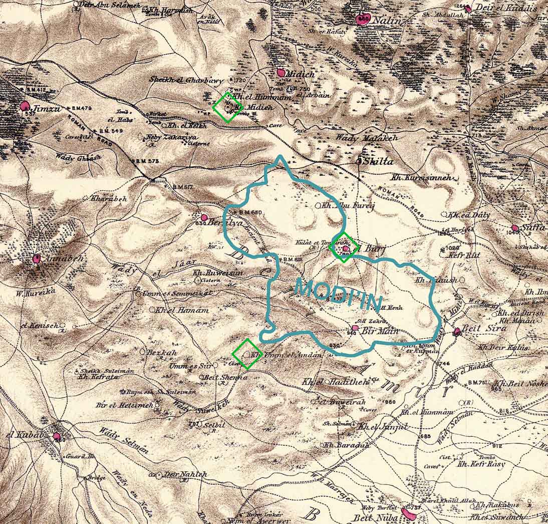
Combination of portions of two maps produced by the Survey of Western Palestine, first published in 1880 by the Committee of the Palestine Exploration Fund. The editor, Walter Besant, died in 1901.
The blue shape gives the approximate boundaries of the build-up area of Modi'in in 2006 (Google Earth). The green diamonds show three scientific theories regarding the location of the ancient city of Modi'in. There are other popular theories.
Produced by Zero0000 using Photoshop 7.0.
[edit] Licensing
| I, the copyright holder of this work, hereby release it into the public domain. This applies worldwide. In case this is not legally possible: Afrikaans | Alemannisch | Aragonés | العربية | Asturianu | Български | Català | Česky | Cymraeg | Dansk | Deutsch | Eʋegbe | Ελληνικά | English | Español | Esperanto | Euskara | Estremeñu | فارسی | Français | Galego | 한국어 | हिन्दी | Hrvatski | Ido | Bahasa Indonesia | Íslenska | Italiano | עברית | Kurdî / كوردی | Latina | Lietuvių | Latviešu | Magyar | Македонски | Bahasa Melayu | Nederlands | Norsk (bokmål) | Norsk (nynorsk) | 日本語 | Polski | Português | Ripoarisch | Română | Русский | Shqip | Slovenčina | Slovenščina | Српски / Srpski | Svenska | ไทย | Tagalog | Türkçe | Українська | Tiếng Việt | Walon | 中文(简体) | 中文(繁體) | zh-yue-hant | +/- |
File history
Click on a date/time to view the file as it appeared at that time.
| Date/Time | Dimensions | User | Comment | |
|---|---|---|---|---|
| current | 10:08, 28 January 2007 | 1,094×1,046 (245 KB) | Zero0000 | (Combination of portions of two maps produced by the Survey of Western Palestine, first published in 1880 by the Committee of the Palestine Exploration Fund. The editor, Walter Besant, died in 1901. The blue shape gives the approximate boundaries of the b) |

