Image:MLS Azimuth Guidance.jpg
From Wikipedia, the free encyclopedia

No higher resolution available.
MLS_Azimuth_Guidance.jpg (640 × 480 pixels, file size: 54 KB, MIME type: image/jpeg)
| | This is a file from the Wikimedia Commons. The description on its description page there is shown below.
|
| Description |
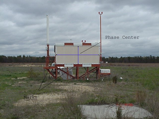
MLS Azimuth Guidance. MLS-AZ Horizontal and Vertical Survey Point:phase center |
|||
|---|---|---|---|---|
| Source |
Mlsaz1.jpg from http://www.ngs.noaa.gov/AERO/navimages/cmanual_mls.html |
|||
| Date |
Unknown |
|||
| Author |
USGS |
|||
| Permission (Reusing this image) |
|
File history
Click on a date/time to view the file as it appeared at that time.
| Date/Time | Dimensions | User | Comment | |
|---|---|---|---|---|
| current | 00:37, 8 November 2006 | 640×480 (54 KB) | Dual Freq | ({{Information |Description=MLS Azimuth Guidance. MLS-AZ Horizontal and Vertical Survey Point:phase center |Source=[http://www.ngs.noaa.gov/AERO/navimages/mlsaz1.jpg Mlsaz1.jpg] from http://www.ngs.noaa.gov/AERO/navimages/cmanual_mls.html |Date=Unknown |A) |
File links
The following pages on the English Wikipedia link to this file (pages on other projects are not listed):

