Image:Mexican Cession.png
From Wikipedia, the free encyclopedia
Size of this preview: 800 × 530 pixels
Full resolution (2,328 × 1,541 pixels, file size: 2.81 MB, MIME type: image/png)
| | This is a file from the Wikimedia Commons. The description on its description page there is shown below.
|
[edit] Summary
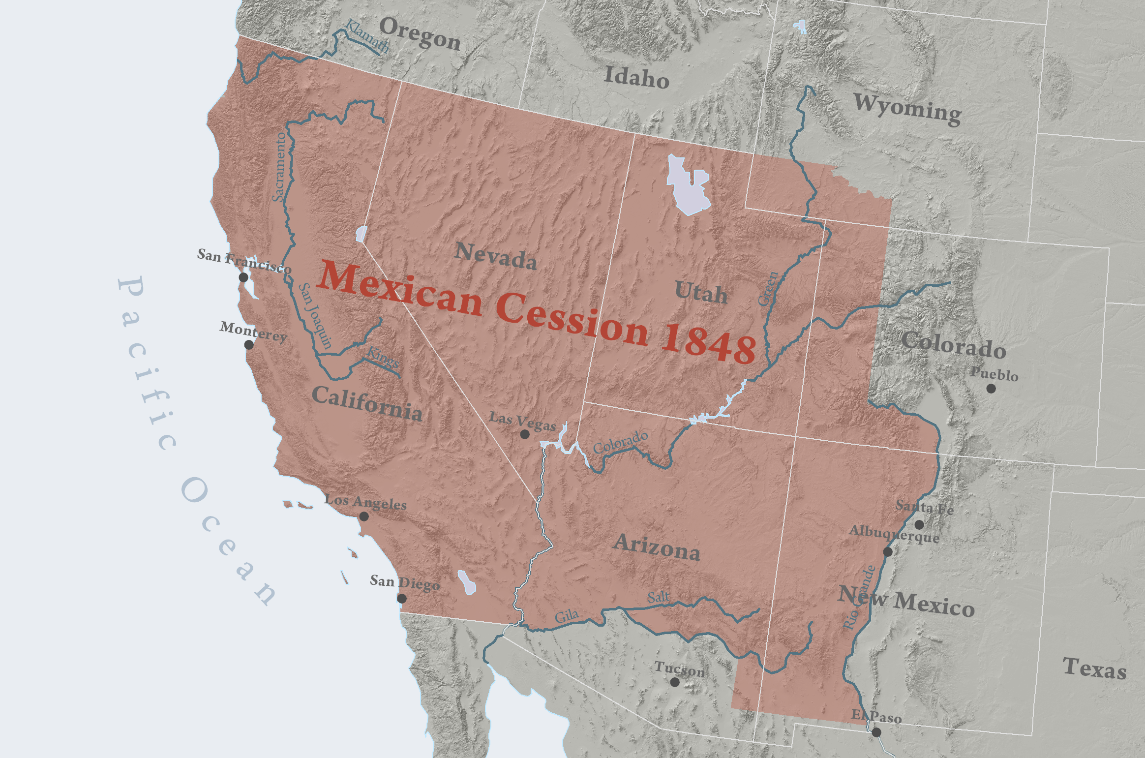
| Description |
Region ceded to the United States of America by Mexico in 1848. |
|---|---|
| Source |
self-made |
| Date |
April 6, 2008 |
| Author | |
| Permission (Reusing this image) |
see below |
[edit] Licensing

| This media file is uncategorized.
Please help improve this media file by adding it to one or more categories, so it may be associated with related media files (how?), and so that it can be more easily found. Please notify the uploader with
Deutsch | English | Español | Français | Italiano | 日本語 | Português | +/- |
File history
Click on a date/time to view the file as it appeared at that time.
| Date/Time | Dimensions | User | Comment | |
|---|---|---|---|---|
| current | 01:56, 14 April 2008 | 2,328×1,541 (2.81 MB) | Kballen | (({{Information |Description= Region ceded to the United States of America by Mexico in 1848. |Source= Self made. Boundary source is National Atlas of the United States. |Date= April 13, 2008 |Author= Kballen |Permission= |other_versions= }} )) |
| 01:43, 14 April 2008 | 2,328×1,541 (2.81 MB) | Kballen | ({{Information |Description= Region ceded to the United States of America by Mexico in 1848. |Source= Self made. Boundary source is National Atlas of the United States. |Date= April 13, 2008 |Author= Kballen |Permission= |other_versions= ) | |
| 23:08, 6 April 2008 | 2,328×1,541 (2.41 MB) | Kballen | ({{Information |Description= Region ceded to the United States of America by Mexico in 1848. |Source=self-made |Date= April 6, 2008 |Author= Kballen |Permission= |other_versions= }} ) |
File links
The following pages on the English Wikipedia link to this file (pages on other projects are not listed):

