Image:Maumee Bay State Park aerial view.jpg
From Wikipedia, the free encyclopedia
Size of this preview: 800 × 533 pixels
Full resolution (1,500 × 999 pixels, file size: 1.71 MB, MIME type: image/jpeg)
| | This is a file from the Wikimedia Commons. The description on its description page there is shown below.
|
| Description |
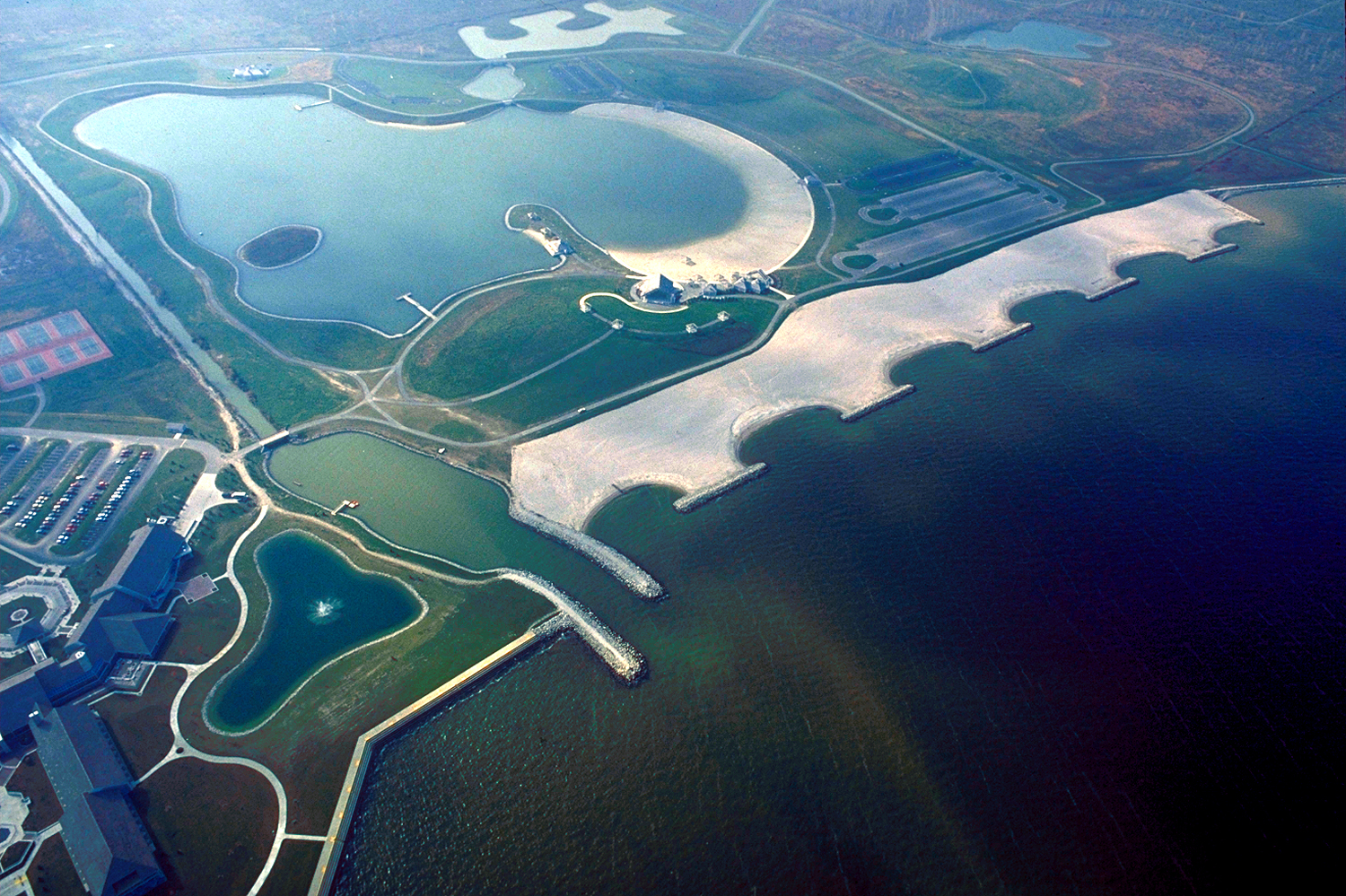
English: Aerial view of Maumee Bay State Park on Lake Erie near Toledo, Ohio, USA. The U.S. Army Corps of Engineers built an artificial headland breakwaters and revetment wall at the park.
|
|||
|---|---|---|---|---|
| Source |
U.S. Army Corps of Engineers Digital Visual Library |
|||
| Date |
October 1, 1992 |
|||
| Author |
Ken Winters, U.S. Army Corps of Engineers |
|||
| Permission (Reusing this image) |
|
| Camera location | This and other geocoded Commons images: | (Info) |
|---|
File history
Click on a date/time to view the file as it appeared at that time.
| Date/Time | Dimensions | User | Comment | |
|---|---|---|---|---|
| current | 17:31, 24 March 2007 | 1,500×999 (1.71 MB) | DanMS | ({{Information | Description = {{en|Aerial view of Maumee Bay State Park on Lake Erie near Toledo, Ohio, USA. The U.S. Army Corps of Engineers built an artificial headland breakwaters and revetment wall at the park.}} | Source = U.S. Army Corps ) |
File links
The following pages on the English Wikipedia link to this file (pages on other projects are not listed):

